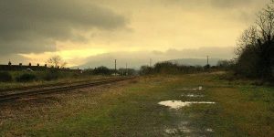
BROWSE THE POTENTIAL GREENWAY PROJECTS
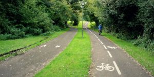
We’re working towards a 1,000km network of greenways across the country, and we’ve split that up into 61 distinct projects. EAch one has its own project page with lots of information on the route, including:
- route type eg former railway
- distance, estimated project cost and timescale
- route images
- interactive map
- progress updates
- resources and information on other sites
To help you browse we’ve grouped the projects by rough area of Northern Ireland. (By all means click on the map, but we’ve no budget to make it do anything).

EASTERN GREENWAY PROJECTS
An upgrade and extension of a coastal path to link Bangor with Groomsport and Donaghadee past Orlock Point.
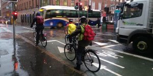
A developing system of urban cycleways to link every part of the city and the surrounding greenway route network.
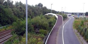
A missing link in an otherwise excellent chain of traffic-free routes between Belfast and Bangor, a 4km urban greenway in Sydenham.

Building on the popularity of the historic 15km Lagan Towpath route between Belfast and Lisburn, much-needed upgrades and extra capacity.
BELFAST TO NEWTOWNABBEY GREENWAY
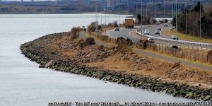
A 9km traffic-free route through the western side of Belfast Harbour and along Belfast Lough shore beside the M2 and M5 motorways to Whiteabbey.
A 2km urban greenway between the Broadway roundabout and Andersonstown along the edge of the Bog Meadows in the west of Belfast.

A community greenway project to provide a traffic-free link between Carryduff and Belfast.

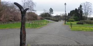
A popular 11km route developed by Sustrans along the old Belfast to Comber railway line opened in 2008 – the original Northern Ireland greenway.
COMBER TO NEWTOWNARDS GREENWAY
A proposed 9km route between Comber and Newtownards using a combination of railway alignment, roads and coastal defence walls.

A standard-setting 9km linear urban park in East Belfast developed along the Connswater River incorporating major flood alleviation works.
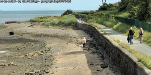
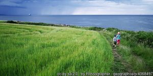
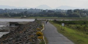
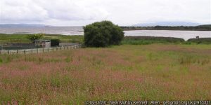
The 16km traffic-free North Down Coastal Path winding through Holywood, Cultra, Helen’s Bay and Crawfordsburn into Bangor.
A 6km greenway route from the Belfast Lough Shore under the Bleach Green railway viaducts and into Monkstown and Mossley.
NEWTOWNABBEY TO CARRICKFERGUS GREENWAY
A 9km route along the disused ‘Back Line’ railway bewteen Monkstown and Greenisland and on into Carrickfergus.
NEWTOWNABBEY TO LARNE GREENWAY
A 26km route from Newtownabbey, linking into the former railhead at Doagh, and on towards the port town of Larne on the Irish Sea coast.
NEWTOWNARDS TO DONAGHADEE GREENWAY
A 14km former railway line running north out of Newtownards turning sharply east below Bangor and across the top of Ards Peninsula to Donaghadee.
NEWTOWNARDS TO NORTH DOWN COASTAL PATH GREENWAY
A proposal to link Newtownards with the North Down Coastal Path
An urban greenway linking the forests of Clarendon and Glencairn Parks down through Woodvale and the Shankill into Belfast city centre.
NORTHERN GREENWAY PROJECTS
A 15km route along the Sixmilewater valley between the town of Doagh and Antrim.
ANTRIM TO DRAPERSTOWN GREENWAY
A 45km route over the top of Lough Neagh from Antrim through Randalstown and Toome through Magherafelt to Draperstown.
BALLYMENA TO BALLYCLARE GREENWAY
A 26km route along the former narrow gauge railway from Ballymena to Ballyclare (and eventually Larne).

BALLYMENA TO CUSHENDALL GREENWAY
The Glens of Antrim Greenway rising from Ballymena over the rugged glens through Glenarriff Forest park towards Cushendall.
A 20-25km route linking the greenways terminating at Ballymena with the northern portion of the greenway network.

BALLYMONEY TO BALLYCASTLE GREENWAY
A 30km route linking Ballymoney with the coastal town of Ballycastle, running under the road at the Dark Hedges.

COLERAINE TO BALLYMONEY GREENWAY
A 15km route along the current railway, before cutting across the River Bann and following the riverside into Coleraine.
COLERAINE TO GIANT’S CAUSEWAY GREENWAY
Upgrading the existing road-based cycle route from Coleraine to Portrush before following the old tramway to Bushmills and the Giant’s Causeway.

A 14km route from the current railway line at the Lough Foyle coastline in to Limavady and on through the countryside to Dungiven.
LIMAVADY JUNCTION TO DUNGIVEN GREENWAY
A 14km route from the current railway line at the Lough Foyle coastline in to Limavady and on through the countryside to Dungiven.
SOUTHERN GREENWAY PROJECTS
A 57km route through counties Armagh, Monaghan and Louth linking Armagh City with Keady, Castleblayney and Dundalk.

A 26km route from Armagh through Killylea, Tynan, Caledon and Glaslough on the way to Monaghan town.

A 33km intercity route from Armagh to Newry through Markethill and the mile-long Lissummon Tunnel.
A 15km route from Portadown along the former Great Northern Railway line, passing by Richhill, to Armagh City.

A 6km branch off the main Belfast to Newcastle railway line, this could be an important active travel link into Ballynahinch.
BANBRIDGE TO NEWCASTLE GREENWAY
A 35km route along the Great Northern Railway line between Banbridge, Castlewellan and the coastal town of Newcastle.
A short 10km route which linked the (former) Banbridge to Newcastle railway line with the (existing) Belfast to Dublin railway line.

A former tramway from Bessbrook down the hill and under the Craigmore Viaduct, carrying today’s Belfast to Dublin train, into Newry City.
Extending the Comber Greenway route by 55km through Ballygowan, Saintfield, Crossgar, Ballynahinch and Downpatrick to the Mournes.
Ireland’s best dedicated urban active travel network, the Black Paths link the towns of Portadown, Craigavon and Lurgan.
DOWNPATRICK TO ARDGLASS GREENWAY
A branch line off the former Belfast and County Down Railway between Belfast and Newcastle, this 13km route could funnel tourists into Ardglass.
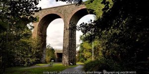
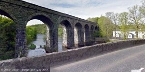
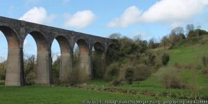
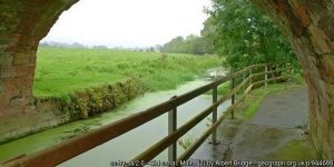
A meandering 26km route from Lisburn through Hillsborough and Dromore’s spectacular viaduct to Banbridge.
Following the route of the Lagan Canal out from Lisburn to Lough Neagh and down towards Lurgan to form a 29km greenway.

A 74km route along the Ulster Canal – being restored in stages – through four counties and linking Lough Neagh with Upper Lough Erne.

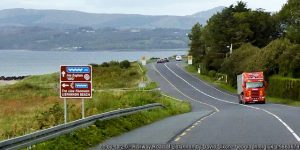
A 42km route linking the historic port of Newry with the working port at Greenore along Carlingford Lough shore all the way around to Dundalk.

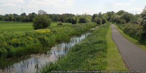
A 29km towpath along the disused Newry Canal from Portadown through Scarva and Poyntzpass into Newry City.
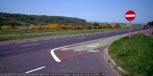
A potential 10km traffic-free route alongside the A2 dual carriageway which was built on the former railway between Newry and Warrenpoint.

PORTADOWN TO DUNGANNON GREENWAY
A 25km route starting up the ‘Derry Road’ from the existing railway station at Portadown across the Blackwater and into Dungannon.
WESTERN GREENWAY PROJECTS
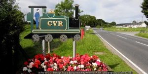
CALEDON TO MAGUIRESBRIDGE GREENWAY
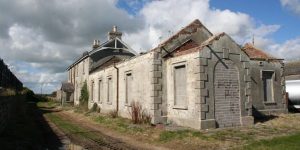
A 60km route following the line of the former Clogher Valley Railway and the succession of roadside railway stations still standing along the way.
COALISLAND TO MOY AND CHARLEMONT GREENWAY
A 7km pathway along the side of theand Canal
DERRY TO BUNCRANA AND LETTERKENNY GREENWAY
A 33km route along the line of the old Londonderry and Lough Swilly Railway from Derry City up to Buncrana and down to Letterkenny.
A 10km route proposed to run along the western edge of Lough Foyle linking the City of Derry with the town of Muff in Donegal.

Following the old ‘Derry Road’ line, this potential 60km greenway would run from Omagh through Strabane and along both banks of the Foyle into Derry.

A developing network of traffic-free routes through Derry linking communites with shopping, leisure, employment and transport hubs.

DUNGANNON TO BALLYGAWLEY GREENWAY
With a new dual carriageway bypassing the old A4 road from Belfast to Enniskillen, the remaining road could eventually host a 21km roadside greenway link.
DUNGANNON TO COLERAINE GREENWAY
A winding 85km former railway route through mid Ulster through Cookstown, Magherfelt, Maghera, Garvagh and Kilrea.
ENNISKILLEN TO CLONES GREENWAY
A 35km route heading southeast out of Enniskillen along Upper Lough Erne passing Maguiresbridge and Linsaskea before turning into Clones.
A 72km route heading west from Enniskillen, under the shadow of Belmore Mountain, turning through Belcoo / Blacklion and on towards Sligo.
The ‘Derry Road’ out of Omagh tacking 40km through Tyrone countryside through Sixmilecross and Pomeroy and into Dungannon.

Former railway route 43km south from Omagh passing Fintona and the junction to Bundoran before going through Ballinamallard into Enniskillen.

STRABANE TO BALLYBOFEY AND STRANORLAR GREENWAY
A 22km route following the line of the former Finn Valley Railway west from Strabane into Ballybofey and Stranorlar in Donegal.
A walkway along the old Strabane Canal from Strabane town up to the River Foyle near Cloughcor.
Two neighbouring towns and three converging rivers, a cross-border greenway project being supported by EU funding to link Strabane with Lifford.
TRILLICK AND BALLINAMALLARD TO BELLEEK GREENWAY
A 45km route off the Enniskillen to Omagh line at Bundoran Junction skirting the top of Lough Erne out to Belleek and Bundoran in Donegal.