PORTADOWN TO DUNGANNON GREENWAY
“Derry Road Greenway”
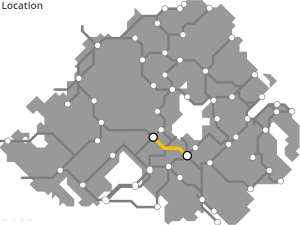
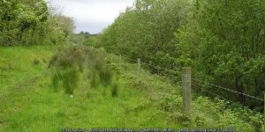
A 25km route starting up the ‘Derry Road’ from the existing railway station at Portadown, and the Newry Canal Path which follows the railway line south, across the Blackwater River and into Dungannon.
ROUTE DETAILS
| Length | 25 kilometres |
| Estimate | £3.8 million |
| Timescale | 2026 to 2040 |
| Type | Former railway |
| Title | Great Northern Railway |
| Border area | No |
| Councils | Armagh City, Banbridge and Craigavon Borough Council |
| Mid Ulster District Council |
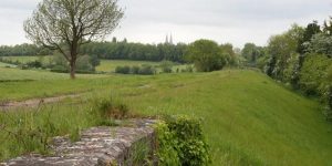
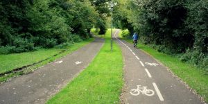
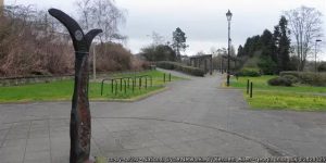
IMAGES


PROGRESS UPDATES
Idea stage
Feasibility
Construction
Completed
June 2016: ACBCBC applies to Stage 1 of the DfI Small Grants Programme for Greenways competition
November 2016: ACBCBC secures DfI £8,000 grant funding for a feasibility study for “Portadown – (North of) Moy greenway”
August 2017: “Portadown – (North of) Moy greenway” misses cut at DfI Small Grants Programme stage 3
August 2018: £25,000 funding announced for “Portadown to Moy greenway” detailed design study
February 2019: ABCBC seeks views on proposed greenways
RESOURCES ELSEWHERE
Closure of ‘Derry Road’ a great loss to Ireland (Derry Journal)
Rail link to Omagh would cost £500 million – report (Ulster Herald)
Portadown, Dungannon and Omagh Junction Railway (Wikipedia)
Exercise Explore Enjoy: A Strategic Plan for Greenways (Department for Infrastructure) PDF 2.8MB
Strategic Plan for Greenways Base Report (AECOM, Sustrans, DfI) PDF 15.7MB
GREENWAY PROJECTS WHICH INTERSECT
A 15km route from Portadown along the former Great Northern Railway line, passing by Richhill, to Armagh City.
Ireland’s best dedicated urban active travel network, the Black Paths link the towns of Portadown, Craigavon and Lurgan.

DUNGANNON TO BALLYGAWLEY GREENWAY
With a new dual carriageway bypassing the old A4 road from Belfast to Enniskillen, the remaining road could eventually host a 21km roadside greenway link.
DUNGANNON TO COLERAINE GREENWAY
A winding 85km former railway route through mid Ulster through Cookstown, Magherfelt, Maghera, Garvagh and Kilrea.

A 74km route along the Ulster Canal – being restored in stages – through four counties and linking Lough Neagh with Upper Lough Erne.

A 29km towpath along the disused Newry Canal from Portadown through Scarva and Poyntzpass into Newry City.
The ‘Derry Road’ out of Omagh tacking 40km through Tyrone countryside through Sixmilecross and Pomeroy and into Dungannon.
GET INVOLVED
Successful greenway projects are driven by the passion of local people. If you have an update to share, a story to tell about the history of the route or future of the Portadown to Dungannon Greenway, or if you want to submit a picture or video to this page, please get in contact.