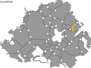
NEWTOWNABBEY TO LARNE GREENWAY
“Ullans Greenway”
A 26km route from Newtownabbey, using the old railway links between Belfast and Ballyclare and the old Ballymena and Larne Railway, linking into the former railhead at Doagh, and on towards the port town of Larne on the Irish Sea coast.
ROUTE DETAILS
| Length | 26 kilometres |
| Estimate | £3.9 million |
| Timescale | 2026 to 2040 |
| Type | Former railway |
| Title | Belfast and Northern Counties Railway (NCC) |
| Border area | No |
| Councils | Antrim and Newtownabbey Borough Council |
| Mid and East Antrim Borough Council |
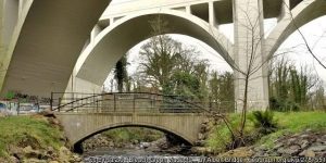
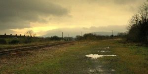
IMAGES


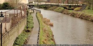
 ©Kenneth Allen")
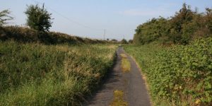
 ©Albert Bridge")
PROGRESS UPDATES
Idea stage
Feasibility
Construction
Completed
June 2016: ANBC applies to Stage 1 of the DfI Small Grants Programme for Greenways competition
November 2016: ANBC secures DfI £8,000 grant funding for a feasibility study for “Doagh to Larne greenway”
August 2017: “Doagh to Larne greenway” misses cut at DfI Small Grants Programme stage 3
August 2018: £25,000 funding announced for “Doagh to Larne greenway” detailed design study
January 2019: “Doagh to Larne Greenway” – Public Consultation on Feasibility
GREENWAY PROJECTS WHICH INTERSECT
A 15km route along the Sixmilewater valley between the town of Doagh and Antrim.
BALLYMENA TO BALLYCLARE GREENWAY
A 26km route along the former narrow gauge railway from Ballymena to Ballyclare (and eventually Larne).
BELFAST TO NEWTOWNABBEY GREENWAY
A 9km traffic-free route through the western side of Belfast Harbour and along Belfast Lough shore beside the M2 and M5 motorways to Whiteabbey.
A 6km greenway route from the Belfast Lough Shore under the Bleach Green railway viaducts and into Monkstown and Mossley.
NEWTOWNABBEY TO CARRICKFERGUS GREENWAY
A 9km route along the disused ‘Back Line’ railway bewteen Monkstown and Greenisland and on into Carrickfergus.
GET INVOLVED
Successful greenway projects are driven by the passion of local people. If you have an update to share, a story to tell about the history of the route or future of the Newtownabbey to Larne Greenway, or if you want to submit a picture or video to this page, please get in contact.