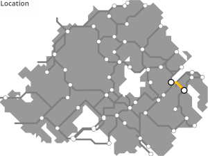
BELFAST TO COMBER GREENWAY
“The Comber Greenway”
When the former Belfast and County Down Railway closed in the 1950s, the government held onto the land expecting to build the M7 motorway. Informal walkways developed along the urban sections over the decades, and when a sewer upgrade was planned in the 2000s, a full conversion to a greenway was delivered – Ireland’s first “greenway” and (still) the benchmark by which other local schemes are measured.
ROUTE DETAILS
| Length | 11 kilometres |
| Estimate | Completed |
| Timescale | Completed |
| Type | Former railway |
| Title | Belfast and County Down Railway |
| Border area | No |
| Councils | Ards and North Down Borough Council |
| Belfast City Council | |
| Lisburn and Castlereagh City Council |
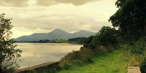
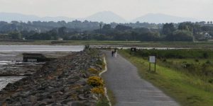
IMAGES
 after The Twelfth ©nigreenways")


PROGRESS UPDATES
Idea stage
Feasibility
Construction
Completed
November 2008: Comber Greenway opening welcomed (Belfast Telegraph)
February 2012: Comber Greenway to extend to Titanic Quarter (BBC NI)
January 2015: Comber Greenway land ‘won’t be sold off’, says DRD (Belfast Telegraph)
May 2016: Euro funding boost for Comber Greenway (Bikefast)
August 2016: ‘Share, Respect, Enjoy’ call for the Comber Greenway (Belfast City Council)
January 2018: Work to widen Comber Greenway underway (Irish News)
March 2020: Northern Ireland Assembly Adjournment Debate on the Comber Greenway (YouTube)
July 2020: Comber Greenway usage up amid calls for an upgrade (Belfast Telegraph)
November 2020: Calls for lights to be installed on the ‘pitch black’ Comber Greenway (Belfast Live)
December 2020: Infrastructure Department announces Comber Greenway usage has increased >75% from Apr to Nov 2020 (Twitter)
January 2021: Calls for ‘hazardous’ Comber Greenway to be gritted (Belfast Live)
RESOURCES ELSEWHERE
Comber Greenway, Belfast – Britain’s Best Bike Rides (The Guardian)
Dundonald Railway Station, Then and Now…
Sustrans One Path Initiative (Lisburn and Castlereagh City Council)
Comber Greenway Upgrade (Cargobike Dad)
Belfast and County Down Railway (Wikipedia)
Exercise Explore Enjoy: A Strategic Plan for Greenways (Department for Infrastructure) PDF 2.8MB
Strategic Plan for Greenways Base Report (AECOM, Sustrans, DfI) PDF 15.7MB
GREENWAY PROJECTS WHICH INTERSECT

A developing system of urban cycleways to link every part of the city and the surrounding greenway route network.
Extending the Comber Greenway route by 55km through Ballygowan, Saintfield, Crossgar, Ballynahinch and Downpatrick to the Mournes.
COMBER TO NEWTOWNARDS GREENWAY
A proposed 9km route between Comber and Newtownards using a combination of railway alignment, roads and coastal defence walls.

A standard-setting 9km linear urban park in East Belfast developed along the Connswater River incorporating major flood alleviation works.
GET INVOLVED
Successful greenway projects are driven by the passion of local people. If you have an update to share, a story to tell about the history of the route or future of the Belfast to Comber Greenway, or if you want to submit a picture or video to this page, please get in contact.