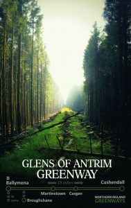
BALLYMENA TO CUSHENDALL GREENWAY
“The Glens of Antrim Greenway”
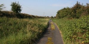
Rising from the Braid River valley, this potential pathway would soar to be Ireland’s highest greenway as it crosses the Glens of Antrim from the bustling town of Ballymena to the coastal peace of Cushendall.
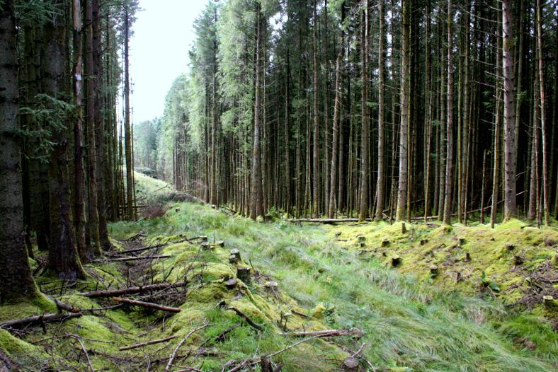
And the cutting through Glenariff Forest Park is a place of tangible magic..
ROUTE DETAILS
| Length | 30 kilometres |
| Estimate | £4.4 million |
| Expected | 2026 to 2040 |
| Type | Former railway |
| Title | Belfast and Northern Counties Railway |
| Border area | No |
| Councils | Mid and East Antrim Borough Council |
| Causeway Coast and Glens Borough Council |
Article: The Glens of Antrim Greenway (September 2015)
“The footprint of the abandoned Ballymena, Cushendall and Red Bay Railway winds silently through the Glens of Antrim. The scenery along the old narrow gauge railway route is truly magical; it’s time to make a nailed-on tourism case for creating a walking and cycling greenway to lift the local economy.
“While decades of farming and community growth makes a route out from Ballymena challenging to say the least, the upper reaches of the old line sit in plain view and unhindered by recent human development.
IMAGES


PROGRESS UPDATES
Idea stage
Feasibility
Construction
Completed
September 2015: NI Greenways publishes article on “The Glens of Antrim Greenway“
June 2016: MEABC applies to Stage 1 of the DfI Small Grants Programme for Greenways competition
August 2016: MEABC establishes Steering Group to pursue Glens of Antrim Greenway development
November 2016: MEABC does not secure DfI £8,000 grant funding for a feasibility study
May 2017: Sections of Glens of Antrim Greenway included in MEABC Cycling Routes Masterplan (PDF 6.7MB)
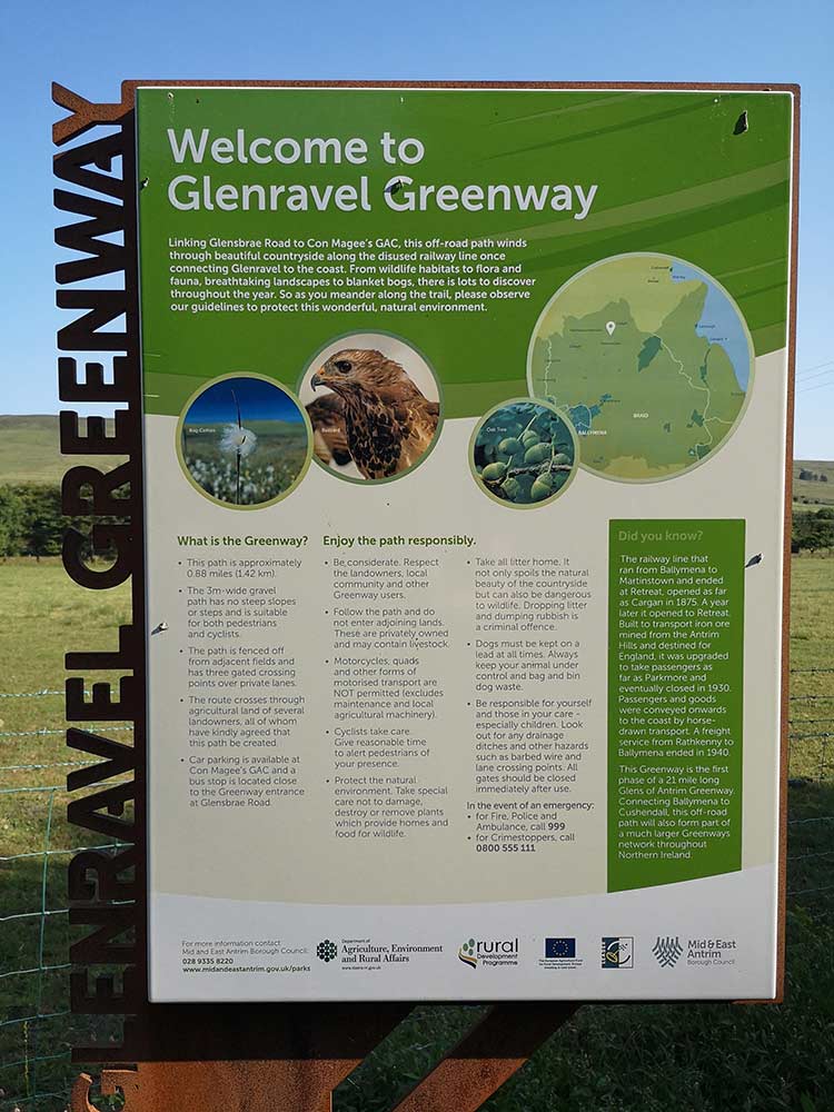
June 2021: Announcement of delivery of 1.4km of greenway between Martinstown and Cargan
RESOURCES ELSEWHERE
New walking trails at Broughshane and Cargan to mark our industrial heritage (Ballymena Guardian)
TV series “Walk the Line” visits Parkmore Station (BBC NI)
Ballymena, Cushendall and Red Bay Railway (Wikipedia)
THE IRON MINES OF GLENRAVEL by Kevin J. O’Hagan (Glens Of Antrim Historical Society)
THE CARGAN to RED BAY WIRE TRAMWAY by Kevin J. O’Hagan (Glens Of Antrim Historical Society)
Exercise Explore Enjoy: A Strategic Plan for Greenways (Department for Infrastructure) PDF 2.8MB
Strategic Plan for Greenways Base Report (AECOM, Sustrans, DfI) PDF 15.7MB
GREENWAY PROJECTS WHICH INTERSECT
BALLYMENA TO BALLYCLARE GREENWAY
A 26km route along the former narrow gauge railway from Ballymena to Ballyclare (and eventually Larne).
A 20-25km route linking the greenways terminating at Ballymena with the northern portion of the greenway network.
GET INVOLVED
Successful greenway projects are driven by the passion of local people. If you have an update to share, a story to tell about the history of the route or future of the Ballymena to Cushendall Greenway, or if you want to submit a picture or video to this page, please get in contact.