Bike Week 2013 offers people in Northern Ireland a unique opportunity to hear from active travel experts and to quiz local politicians on cycling development.

Two free public events in Derry~Londonderry and Belfast on Wednesday 19th June entitled Politically Painless Active Travel will explore the steps to get more people cycling and walking in Northern Ireland. The events are being organised by CTC, Sustrans, Travelwise and Derry City Council.

Registration is free and both events are open to the public.

You can register now for either session on the CTC website.

Headline speakers

Dr Rachel Aldred

Rachel Aldred is a London-based cycling sociologist who teaches and researches transport.

A Senior Lecturer in Transport at Westminster University, blogger and commentator on cycling strategy, policy and culture, Dr Aldred will be speaking about how to reach a critical mass of cycling that flips cycling into the mainstream, and behavioural changes needed for individual and political acceptability.

You can follow Dr Aldred on Twitter at @RachelAldred.

Gordon Seabright

Gordon Seabright is the Chief Executive of the Cyclists’ Touring Club (CTC), the national cycling charity. CTC is an independent charity, with 70,000 members nationally. Gordon took up post in March 2012. He will be giving an overview of the Westminster All Party Parliamentary Cycling Group’s cycling inquiry, getting the fundamentals right and the economic benefits of cycling.

You can follow Gordon Seabright on Twitter at @GSeabright.

Lilli Matson

Lilli MatsonLilli Matson is Transport for London’s (TfL’s) Head of Delivery Planning. She leads TfL’s strategy and planning of surface transport priorities and projects – with a focus on managing freight and transport demand, planning for bus priority across London, promoting walking, cycling, accessible public transport and improving road safety. She will give insights into implementing active travel on crowded roadspace and the political leadership needed.

© Copyright laurentka and licensed for reuse under Creative Commons Licence

Politically Painless Active Travel seminar

Getting more safer walking and cycling
The Guildhall, Derry~Londonderry
10am Wednesday 19 June 2013

10.00 Registration and coffee

10.20 Jimmy Spratt MLA
Welcome from the Chair of Regional Development Committee

10.25 Dr Rachel Aldred
How to reach a critical mass of cycling that flips cycling into the mainstream and behavioural changes needed for individual and political acceptability

10.50 Denise Gallanagh-Wood (An Taisce) and Michele Murphy (Sustrans)
Getting the nation walking and cycling and the success of green schools in Ireland and Bike It in Northern Ireland

11.15 Dr Willie Burke (Derry City Council) and Ross McGill (Sustrans)
Route Development and promotion in Derry~Londonderry

11.45 Break

12.00 Lilli Matson (Transport for London)
Implementing active travel on crowded roadspace and the political leadership needed

12.25 Gordon Seabright (CTC Chief Executive)
Overview of the Westminster All Party Parliamentary Cycling Group inquiry, getting the fundamentals right and the economic benefits of cycling

12.45 Questions

13.00 Finger buffet

13.30 Walk~Cycle to the Peace Bridge and Riverside Greenway to look at Derry~Londonderry’s active travel infrastructure

14.00 (back at The Guildhall) Sean Lynch MLA
The Deputy Chair of the Regional Development Committee chairs the afternoon session – a member from each of the 5 main Northern Ireland political parties gives the party view on walking and cycling, and then questions from the floor

15.15 Gordon Seabright (CTC Chief Executive)
Summing up

15.30 Close

**Anyone travelling from Belfast to The Guildhall/Peace Bridge event can take advantage of the superb rail link to the North West. Enjoy free WiFi and a relaxing trip along one of the most picturesque rail journeys in Europe. The 07.10 departure from Belfast Great Victoria Street will arrive at Derry~Londonderry at 9.25am. It’s a £17.50 day return from Belfast.

Whoever99 at en.wikipedia [CC-BY-SA-3.0 (http://creativecommons.org/licenses/by-sa/3.0) or GFDL (http://www.gnu.org/copyleft/fdl.html)], from Wikimedia Commons

Politically Painless Active Travel public meeting

Getting more safer walking and cycling
The MAC (The Factory space), Belfast
6pm Wednesday 19 June 2013

18.00 Arrival & registration

18.10 Regional Development Minister Danny Kennedy
Welcome and Minister’s comment

18.15 Gordon Seabright (CTC Chief Executive)
Overview of the Westminster All Party Parliamentary Cycling Group inquiry, getting the fundamentals right and the economic benefits of cycling

18.40 Dr Rachel Aldred
How to reach a critical mass of cycling that flips cycling into the mainstream and behavioural changes needed for individual and political acceptability

19.05 Denise Gallanagh-Wood  (An Taisce)
Getting the nation walking and cycling and the success of green schools in Ireland

19.30 Tim Edgar (CTC)
CTC Bike Club and Belfast City Council

19.45 Beth Harding (Sustrans)
The results from working in schools

20.00 Gordon Clarke (Sustrans Director Ireland)
Summing up

20.10 Questions

20.25 Regional Development Minister Danny Kennedy
The Minister’s closing comments

20.30 Close

You can register now for either session on the CTC website.

The North Down Coastal Path, and the surrounding local economy, is one major project away from fulfilling its tourism and leisure potential. A new high quality traffic-free link is needed to address the current disconnection from Belfast. This will integrate with the growing urban greenway network, encourage Belfast residents to visit North Down more regularly, and open up a new seam of tourism opportunities. Considering the current options for route development, an intriguing new greenway project is proposed.

Explore the Belfast urban greenways on Google Maps
Traffic-free network in Greater Belfast Area – disconnected from the North Down Coastal Path

.
The North Down Coastal Path begins at the north end of the George Best Belfast City Airport runway, with a gate to the road running past the Kinnegar Army base. From here, Belfast City Hall is 6.5km away with no direct traffic-free route. When the Connswater Community Greenway is completed as far as Victoria Park the shortest distance to this pathway network will be 4.5km, but accessible only by busy main roads.

This is a particular problem for leisure cycling; families with youngsters, inexperienced cyclists, tourists based in Belfast. These are already significant distances before the relaxed ‘leisure’ part begins, and poses a barrier to many people who would otherwise love to tootle along the coast for a day and spend in the local economy.

At present there are just two options available for travelling by road. Both routes are quite direct, but also have severe drawbacks for cycling and walking.

The A2 / Sydenham Bypass

The road ‘benefits’ from separate cycle tracks on both carriageways, but you’ll seldom see people choosing to take this route. This is quite a horrible place to be on a bicycle; a heavy traffic urban dual carriageway, with vehicles travelling above and below the 50mph speed limit.

An apparent lack of sweeping leaves the cycling surface strewn with road grit and glass. Not a happy start or end to a leisure trip, and not somewhere suitable for children or inexperienced riders to cycle. Great if you like cinematic thrills, but not fit for purpose as a modern cycle route.

Sydenham Bypass cycle lane, murderous traffic, puncture-friendly surface

It’s hard to imagine a country like the Netherlands, where road design is based on sustainable safety principles, funnelling cyclists into the hard shoulder of what is practically an urban motorway, then promoting it as an important link in the country’s cycle network.

Pedestrian access to the bypass is slightly easier with the footbridge at Sydenham Station and subway by Victoria Park, but the drawbacks of the traffic noise and fumes make this a less than appealing environment. Popular with joggers and power walkers, but lacking in great utility.

Future development of the road will include widening to three lanes each way. There will be just one 3.5m shared cycle/footway on the Victoria Park/Airport side – finally to include a physical barrier which should improve safety perception – but designing a mixed footpath on this fast cycling commuter route is a real backward step.

As the Sydenham Bypass reaches the Tillysburn Gyratory, it’ll be back to the current heady mix of footpaths, hard shoulders and crossing over fast slip roads. With no cycle lane up the slip road to Holywood Exchange, cyclists are encouraged to continue for another 2.6km on the dual carriageway into Holywood town, missing the first section of coastal path.

While it’s important to retain cycling and walking space in major road developments, this appears to be an ideal time to seek better accommodation for sustainable journeys on this corridor.

The Airport Road

Favoured by many cyclists at present, the Airport Road tracks the western side of George Best Belfast City Airport. By comparison with the Sydenham Bypass, the traffic flows are greatly reduced. Yet heavy goods vehicles and oil tankers dominate the road here, and again this poses a frightening dilemma for the novice cyclist. The pathways suffer from high kerbs and no dropped access at the many side roads; unsuitable for cycling, so the road is the only option at present.

There are plenty of opportunities on the countrybound side to reclaim space to develop a separate cycle track with the parallel pedestrian pavement. This is understood to be the preferred solution for a future cycling route, with a new bridge due to link Victoria Park with the Airport Road at the end of the Connswater Community Greenway.

Airport Road Belfast

Yet there is another issue which makes this route currently unattractive – the isolation. There is one way in and one way out, with some limited added value with the commuting link to the Bombardier site and businesses based in the Heron Road Complex. But workers here will tell you the dirt left by heavy construction traffic makes cycle commuting conditions less than ideal.

The Airport Road option also narrows the usefulness of the route to cyclists only. Very few ‘additional’ walking journeys would be generated along this stretch, being set so far away from residential areas.

But is there another way to accommodate sustainable transport in this part of the city, and link the greenway networks, away from the compromises of being tied to major roads?

A Sydenham Community Greenway?

Looking to the southeast side of the airport, across the A2 and railway line, there is another option worth exploring which ticks many more boxes:

  • direct route
  • traffic-free
  • space for full mode separation where needed
  • integration with rail network
  • greater number of access points
  • weaving through residential communities
  • integration with existing leisure facilities
  • new commuting and shopping access

Sydenham Community Greenway proposal section 1

Starting from the Connswater Community Greenway link to Victoria Park, this route would make use of Inverary Drive. This traffic-calmed and relaxed residential road is an ideal start, running for almost a full kilometre. There is an existing bridging pathway between Park Road and Inverary Drive which can be upgraded to greenway standard.

Inverary Drive pathway

Inverary Drive is a wide and calm street environment with very little through traffic. It’s possible to accomodate cycling on the road (with a 20mph limit) but space exists to provide a fully separate track by the railway fence for a ‘continuous’ route feel, and providing the highest safety standard to separate pedestrians, cyclists and other vehicles for this short stretch.

Inverary Drive

There is an important link with Sydenham railway station on this route, and a greenway route on the doorstep opens this station up as a jumping off point for journeys towards the Connswater/Comber corridor, and north where we’re headed.

Continuing on, the road turns east into Inverary Avenue at the Inverary Community Centre, but this proposal would run a traffic-free path behind the centre and through Alderman Tommy Patton Memorial Park. This popular urban park has recently upgraded its play facilities, and is another lesser-known gem in Belfast. Passing by the football pitches, the new path would approach a patch of woodland. There is an existing looped forest pathway which runs along the boundary with the train line; this could be carefully and respectfully upgraded for the purposes of a continuous greenway route.

Alderman Tommy Patton Memorial Park woodland path

Viewed from the woodland path, the potential local benefits of the next section start to snowball – the main terminal of George Best Belfast City Airport is but a stone’s throw away. The greenway would continue to follow the line of the railway fence, across the back of Shorts Recreation Club and Blanchflower Park.

George Best Belfast City Airport

As with Alderman Tommy Patton Memorial Park, there appears to be ample space to set the railway fence back closer to the line if it’s necessary to accommodate the path away from the existing parks. But for the whole route to be viable, one piece of major engineering is needed at this point.

SydBridge
A very poor artist’s impression of a standalone bridge

The most direct route to Holywood requires the path to cross over the railway lines opposite the airport. There are two options here:

  • a standalone bridge crossing diagonally to meet the airport exit road
  • a looped ‘S’ bend crossing over the railway tunnel at the Sydenham Bypass and turning again into the airport exit tunnel

George Best Belfast City Airport Access Underpass

A simple upgrade of the airport access tunnel can continue the route towards Holywood Exchange. The tunnel already has a wide footpath and cycle lane marked on the road. Providing kerb separation at the exiting cycle line would allow 2-way cycling and walking without affecting airport traffic. There is a further option to drop an access path from the countrybound Sydenham Bypass, allowing direct cycling and walking access from the Tillysburn cycling underpass and linking the communities around Knocknagoney Park.

Sydenham Community Greenway proposal section 2

The City Airport site employees around 1,500 people, with many workers travelling from East Belfast with little option but to drive. This new greenway option opens up a significant swathe of Belfast to a truly viable alternative to car travel. And if you think the suggestion of cycling to an airport for onward travel is daft, this isn’t the case at other airports around the world, even including many served by George Best Belfast City Airport flights.

Holywood Exchange abandoned access road behind IKEA

The roundabout at the airport tunnel leads off to an abandoned access road. Today this is used for fly tipping and is a favourite spot for taxis wanting to beat the waiting restrictions within the airport car parks. This is ripe for conversion to a walking and cycling-only route into the Harbour Estate at Holywood Exchange as part of the greenway. The proposed path would cut left alongside the airport boundary fence and into the retail complex at IKEA’s massive sign. There is already a natural land buffer between the airport boundary fence and Airport Road West, ripe for a separate cycle track all the way to the North Down Coastal Path.

IKEA sign at the George Best Belfast City Airport boundary fence

Hundreds more local workers travel to the large businesses situated here: IKEA, Decathlon, B&Q, Sainsburys, Next, BHS, Harvey Norman. Commuting options are increased for locals, but also new options for shopping trips..

Cough cough .. stop right there! Shopping at IKEA? By bike?!

If the idea of cycling to IKEA to go shopping seems even more daft than the airport link, it’s perfectly obvious, natural and not uncommon in other countries. The difference between a city like Copenhagen and Belfast is exactly the type of traffic-free infrastructure being proposed here.

geograph-1274238-by-Rossographer

The separate cycle pathway would continue along the airport boundary fence until passing out of the Holywood Exchange complex, before turning under the flight path at the end of the runway. This is another one of those little treasures of Belfast – standing under a landing aircraft seemingly at touching distance.

Getting from the airport side to the Kinnegar gates requires a road crossing – the only one on this entire 4km route. The bulk of traffic on the road only goes as far as the retail park, so a pelican crossing  beyond B&Q could be an appropriate solution. Once the confusing access issues with the Habour Tillysburn gates are ironed out, a continuous link to the North Down Coastal Path is now achieved.

Local value of a long-distance greenway

Running the connecting greenway through a residential community rather than the Airport Road must be carefully weighed. The main local benefit would be the potential displacement of some regular private car journeys to cycling and walking.

The 3 wards surrounding this proposed route, Sydenham, Island and Belmont, have just over 16,000 residents. Census figures bear out that these ‘greenway wards’ are not much different from the rest of Belfast; just shy of a quarter of all commuting journeys are under 2km (1.2 miles) and nearly two thirds within 5km (3 miles) range. Yet motorised trips are higher here at 56% (48% all Belfast) and walking journeys lower at 17% (22% all Belfast). One third of households in the greenway wards have no access to a car, which is a high figure in itself, but less than the Belfast average (40%), so the area is possibly more car dependant that it needs to be.

Alderman Tommy Patton Memorial Park entrance path
Alderman Tommy Patton Memorial Park linking greenway trips to Ashfield High Schools?

While the footprint of the proposed greenway is on the periphery of the residential area in these wards, it would still open up new linkages into the harbour estate and enhanced traffic-free sections for many parents and children on the school run to Victoria Park Primary School, Ashfield High Schools and Sandbrook Nursery School.

A potential new community greenway for Belfast, linking the city with the North Down Coastal Path, providing viable commuting, shopping and leisure alternatives to private car travel. On the face of it would seem a very cost-effective option should Belfast City Council, Northern Ireland Government departments, Sustrans or others wish to take it forward with a feasibility study. With just a few wrinkles to be ironed out on access, this would seem to provide excellent value for money – a 4km Sydenham Community Greenway as the final piece of a fully connected Belfast Metropolitan Area greenway network. Is it possible?

The North Down Coastal Path remains a gem in Northern Ireland’s tourist and leisure offering. The section from Holywood to Bangor stretches 10 miles along rocky shores, fine sandy beaches, quiet coves, country parkland, busy promenades and moments of perfect isolation. This post celebrates the importance of the North Down Coastal Path, and looks at the work ahead to release its full potential.

© Copyright Michael Parry and licensed for reuse under Creative Commons Licence

As a kid growing up in Troubles Belfast, there was always a little bit of magic about day trips to North Down. Whether it was the chocolate box train stations, the many fun activities, or just the sharp change of scenery just minutes out of the city, it was an easy place to fall in love with. Finding out that there was a ‘secret path’ that went for miles around the coast added to the mystique. It later became a favourite adventure to cycle* from Belfast to Bangor and back.

Explore the North Down Coastal Path on Google Maps

The attraction of the Coastal Path today is just as great. Starting on the Belfast side, the path begins around Holywood, starting its close relationship with both the sea and the railway as it passes close to Holywood Station. There are 8 railway stations from Holywood to Bangor and most are with 500m of the Coastal Path, making short trip options wonderfully flexible. The section at Seapark, according a recent tendering process, will shortly be upgraded to enhance walking and cycling* access. Striking out from the urban environment the path passes playgrounds and millionaires’ retreats, mixing shared footpaths with residential roads.

Ross [CC-BY-SA-2.0 (http://creativecommons.org/licenses/by-sa/2.0)], via Wikimedia Commons

The first stop of major interest is at Cultra. The Ulster Folk and Transport Museum covers a large area on both sides of the busy A2 road, and the two sites have enough of interest for a day trip each. These museums cover a vast timeline of Irish cultural and engineering history. Unfortunately there is no direct access from the Coastal Path into the Transport Museum site, with a long trip up the nearby Glen Road and back down to the main entrance the only option.

Onwards to Station Road, marking the end of the residential sections of the route, and a fierce contrast to the smooth promenades and streets so far. Crossing the boundary of the Royal Belfast Golf Club, a tight mud/gravel path clings to the shoreline, between crass fencing and artificial sea defences.

© Copyright Eric Jones and licensed for reuse under Creative Commons Licence

Some sections near here are due for upgrade, but a comprehensive look at improvements to weak links in the chain is necessary. Comments on Twitter suggest commuters to Belfast from Seahill and further would benefit from a realistic option to cycle* somewhere other than the main A2. Improvement works have been seen in recent years, especially as we move on past the Rockport School.

© Copyright Eric Jones and licensed for reuse under Creative Commons Licence

Approaching Seahill there is a rocky inlet which is traversed by two flights of steps and a high narrow path. This effectively cuts the Coastal Path in half for wheelchair users and anyone pushing a bicycle* who may be unable to lift and carry a bike up and down the narrow flights.

© Copyright Albert Bridge and licensed for reuse under Creative Commons Licence

North Down Borough Council have been working with the Northern Ireland Environment Agency to provide a sustainable and environmentally acceptable alternative. This is currently planned to be a boardwalk, level with the rest of the path. Once completed this will boost the potential of the entire route.

A leisurely stretch brings us to Helen’s Bay, and as the path turns southeast towards Bangor, the Grey Point Fort dominates the headland. Sighting Scotland for the first time, a steep climb and a quick nip onto the local road finds us dandering down towards Crawfordsburn Country Park.

© Copyright Albert Bridge and licensed for reuse under Creative Commons Licence

On sunny summer days the beach and surrounding fields come alive with day trippers tucking into picnics and the sounds of delighted kids. Secluded woodland walks, waterfalls and spectacular railways arches lie in wait away from coastline. In days gone past the railway halt at Crawfordsburn allowed day trippers the option of a train directly to the beach path. Today the Helen’s Bay Station is still close, but the vast majority of visitors to Crawfordsburn Country Park still arrive by private vehicle.

© Copyright Kenneth Allen and licensed for reuse under Creative Commons Licence

Passing the impressive Crawford House complex (read more about the history of Crawfordsburn Park on the Lord Belmont in Northern Ireland website), wide promenades have taken us across two beaches. Reaching Swineley Bay, the path stops abruptly and it’s a dander over the sand to the other side of the beach. Not too much of a problem for ramblers, joggers and dog walkers, but another difficulty for anyone with self-propelled transport*.

© Copyright Eric Jones and licensed for reuse under Creative Commons Licence

The Coastal Path and railway line finish their game of hide and seek as the outskirts of Bangor are reached at Carnalea Golf Club. Leaving sandy beaches behind for more rocky shores, the path twists and undulates towards Smelt Mill Bay, naturally regulating any speeding wheels*. Turning round to face Bangor Marina, the Pickie Pool may no longer stand proud on this side of town, but today’s Pickie Fun Park shows how investment in new facilities can reap great rewards for a local economy.

© Copyright Rossographer and licensed for reuse under Creative Commons Licence

Tourism has influenced the development of Bangor since Victorian times, and although slow to respond to the changing holiday habits from the 1960s onwards, the town is beginning to thrive on smart investments such as the Marina complex and integrated transport hub. The North Down Coastal Path may be a small part of the overall package for Bangor, but with Belfast just a couple of leisurely hours away by bike* and tourism becoming more important to Northern Ireland as whole, the North Down Coastal Path should be given greater marketing prominence as a high quality active travel corridor.

To cycle* or not?

Two issues seem to dominate discussion of shared paths like this one, dogs and cyclists. It may come as a surprise how the the issue of cycling has been settled – North Down Borough Council by-laws prohibit cycling on any part of the North Down Coastal Path. Hence the coy cycling* references earlier!

Councillors are actively working on solving this problem, now widely recognised as outdated and largely unenforced in practice. In fact, Council cycling information signs are common along the route, and leaflets on the North Down Borough Council website even promote Sustrans’ National Cycle Network as running on sections of the path.

While mixing cyclists with ramblers can be difficult, the North Down Coastal Path for the most part naturally calms the top speed of leisure cyclists – either by tight twisting passages or the relentless glorious scenery to be savoured. This is not a welcome nor coveted environment for faster road cyclists or Strava junkies, especially as many sections are still suitable for a mountain bike only.

There is perhaps a more fundamental tension at work here between the interests of local users and those wishing to develop a route capable of attracting and handling higher usage. The same complaints play out on the Lagan Towpath and Comber Greenway, but everyone must face the reality that these routes are being developing as mixed use to maximise the numbers and range of users.

Consideration and respect is necessary for a harmonious environment; prohibition is a blunt instrument which isn’t working and holds the path back. The local economy can only benefit from increased usage of the path by day tripping cyclists from Belfast, whether resident or tourist.

Tillysburn gates confusion

Getting to the North Down Coastal Path from the Belfast side is challenging, and there is a need for a new traffic-free route into Belfast. From The Esplanade in Holywood there is a quiet coastal road which leads to the entrance of the Belfast Harbour Estate at the end of the George Best Belfast City Airport runway. The road is private, owned by the Ministry of Defence as part of the Kinnegar Barracks, yet walking and cycling is so common and accepted that the gates onto the Harbour Estate are now permanently open.

Kinnegar Gates

This is very welcome for local users but is only one hurdle to a continuous, fully accessible greenway route. Just 100m from this opening are the Tillysburn Harbour Gates, operated by the Belfast Harbour Police.

A sign here suggests overnight closures during the week and shut gates all day Sunday. In conversation with the Harbour Police, these hours were confirmed as open from 6.30am Mon-Sat, closed around 11pm each weekday, causing few problems for commuting and leisure. But the Sunday closure was also confirmed, with the gates locked at 7pm on Saturday night and not opening again until Monday morning – prime time for leisure use.

Tillysburn Gates

To make sure of the situation, I took trip down and observed wide open gates at 12pm on Sunday 21st April, obviously contradicting the only publicly available sources of advice. No accurate information available on the Belfast Harbour website at the time of writing.

It’s a confusing situation for everyone – the very existence of a barrier shown as closed on Google Maps creates uncertainty – and clarity is required. In the first instance the Harbour website needs to be regularly updated with access hours, allowing all the relevant tourism sites to reflect the latest info. In the medium term, a more permanent arrangement for a continuous pathway makes more sense.

This could be achieved either by setting the whole security barrier back by 150m to give a clear route through to Kinnegar, or developing a separate ‘greenway’ path away from the road near to the edge of the lagoon. With the main A2 road unappealing for leisure cycling or rambling, making full use of this section for sustainable travel is essential for the future of the North Down Coastal Path.

For more on the North Down Coastal Path and opening a quality link to Belfast read part two on the Belfast to Bangor Greenway: the final link.

Many thanks for input on both posts from the following Twitter bods: @_Helmholtz_ @BrianLatewood @chasingsilver1 @oceanbump @chris0ward @RichardJeffrey1 @AndrewMuirNI @StripyMoggie @andyboal @10ON12 @collapsibubble @ye_Bhoy_ye @rinkyrinky 

As 2013 arrives, some of us will be taking stock of life, waistlines or bank accounts and deciding to start afresh with some New Year’s resolutions. It’s traditionally a bad time of year for the luxuries in life, while gym owners fill their boots on new memberships – before willpower inevitably fades.

Perhaps these are clichés, or maybe it is a good time to try something new. One of the barriers to making major a successful change in your lifestyle is finding time. There is one activity which ticks the fitness, finance and quality of life boxes, and doesn’t require significant extra time – cycling to work.

Why do I cycle to work?

It’s an easy argument to make as a regular bike commuter in Belfast, but here’s a secret – I don’t always cycle. I own a car, and I occasionally use it for the work run. I’ve been a regular commuter on the Metro bus system. I’ve even been known to walk to work too – it’s just under 3 miles door-to-door. Forget about labelling me as a “cyclist”. I’m a commuter.

But on balance I’ve made the decision to use the bike for commuting all year round for a number of reasons; the short distance, the time saved over other forms of transport, the money saved, and the regular exercise.

I’ve previously posted about why Belfast has the potential to be a great cycling city, and my own commuting journey is fairly typical in Belfast, a small city with a quite centralised employment. So why do more people not use a bike to get from A to B?

It turns out more people already are. In 2001 just 1.4% of Belfast workers listed cycling as their main form of commuter transport. Over 10 years, the number of people cycling has increased by 60%, and cycling now has a 2.1% share.

Comparing journey options

Using the bike certainly feels like the most efficient way to get to work. A steady 15 minutes maximum journey time for a trip of just under 3 miles, regardless of traffic conditions, and no per-journey costs. Even if I didn’t know the comparative journey times, the traffic queues are ever-present and fun to whizz past. Despite cars overtaking me in short stretches, I’ll consistently beat any car door-to-door. But as a multi-modal commuter, I can record and compare my transport options.

Assuming 233 working days a year (subtracting weekends and 28 days statutory leave) I can work out the actual cost savings I make by cycling over taking the car, the bus, or walking. These personal costs can be measured in time and money.

Bicycle vs walking

Walking compares favourably to cycling on cost, as each journey is free – unless you’re counting shoe wear. However, it takes the longest of all options, 45 to 50 minutes. Unless there’s a particular reason to walk (and in Belfast, issues such as flag protests do crop up), it’s not an attractive option. Compared to cycling, I lose 233 hours a year travelling, or 10 full days annually. This is time lost from home life and makes walking my least favoured option.

Bicycle vs bus

During rush hour, it is rare that any Metro bus will stay ahead of me for more than 2 stops. Indeed, the scheduled timetable puts the average rush hour speed at around 8mph, easily slower than the bike. The Metro system in Belfast means that my route has a regular 10 minute service at peak times. While this is very a reliable option, if I exclusively used the bus all year round, the service intervals means the average bus journey includes 5 minute wait at the bus stop. Adding two more 5 minute walks from stops to work and home means that my average journey time is already 15 minutes – the same as the cycling door-to-door – and I haven’t even added the actual bus journey part yet. This is a major disadvantage.

Overall I will lose 155 hours a year, or approximately 6 days, travelling by bus rather than by bike. Bus fares are £1.70 per journey, but if this was my main transport option, taking advantage of a Metro Smartlink card would see that discounted to £1.10. Still, over a year, that’s £513 pounds out of my pocket for slower journeys.

Bicycle vs car

Attempting to work out costs for my car faces a major variable factor – Belfast city centre parking. I don’t have access to a free car parking space, and I doubt many of us do. My two main choices are on-street parking around my workplace, or a cheaper ‘all-day’ car park.

The on-street option gives me an average door-to-door journey of 25 minutes, but at £1.20 per hour (£9.60 per day) it really hurts the wallet. The closest car park with a ‘commuter’ offer is Castle Court, which has a £4.50 maximum daily rate. However the trade-off is an extra 10 minutes per journey walking to/from work. Petrol costs only around 85p for the round trip each day.

Compared to the bicycle annually, using the car park I lose 155 hours (4 days) and I’m £1,247 worse off, while the on-street option sees me lose just 78 hours (approximately 3 days) but leaving me a whopping £2,435 poorer.

Comparing time and money costs of bike commuting vs walking / bus / car

TransportEfficiency2013

The significant personal journey costs of car commuting are not limited to this example, as the large monthly repayment hole in my bank account will attest. Depreciation, hefty insurance and VED costs, servicing and MOTs must be considered as well.

According to the 2011 Census, 40% of Belfast households have no access to a car or van, and the cost disadvantage must be one of the primary reasons.

Completing the comparison fairly, bikes themselves are not free. However, picking up your main form of transport for between £100-£300, and modest servicing costs from your friendly local bike shop, there really is no comparison to a car on cost.

Witness the fitness

Okay, this blog post can’t ignore the fitness aspect. First, if you met me in person you’d be unlikely to think ‘that person cycles every day’, so cycling to work won’t necessarily give you the figure of an Olympic athlete. But I’ve built 30 minutes of exercise into every working day. That’s a base level of activity that I’d need to find time for elsewhere in the day, for a trip to the gym or swimming pool – time most of us just don’t have. It’s also exactly what the NHS recommends as the level of physical activity needed to stay healthy. So if you want to sneak up on yourself with some exercise, burn a few more calories, and arrive at work invigorated rather than snoozing on the bus or frustrated by gridlock, cycling could be for you!

All things being equal

These are very basic comparisons, which ignore many aspects which are in favour of private car travel, or reduce the choices available to people. The challenge is laid firmly at the feet of the Northern Ireland government to create the conditions for real choice in Belfast.

Some jobs designate workers as essential car users, with sales posts and others requiring quick flexible transport on a daily basis. There is no doubt that the current public transport system, and road infrastructure, doesn’t offer realistic alternatives to some people. However, many arguments for car travel should be first evaluated with the query ‘how do they do it in the Netherlands?’ If cities elsewhere with similar climates have people happily getting on with commuting, shopping, doing the school run and more by bike, and can have modal shares upwards of 20%, even 30%, we’re failing if we say it can’t be done.

Local retailers cry foul when the status quo on our roads is altered, as we’ve seen with Belfast bus lanes. But research is starting to show that cycling customers spend more than car drivers. If the ‘shop local’ agenda is truly to help the many independent retailers dotted around our unique city, advocates need to take safe cycling and walking infrastructure seriously as a means to drive footfall and revenue.

A key argument against cycling infrastructure is that the car is the dominant travel form here because people make rational informed decisions on transport. When the government spends money on “sustainable”  transport, it is an artificial distortion of market forces, prioritising transport modes that will never, or need never threaten the motorised hegemony.

Choices are not equal though. If the main barrier to cycling uptake in Belfast remains fear of the roads, then until we have the type of cycling infrastructure where people of all abilities from 8 to 80 feel safe and secure, then it’s not an equal choice. Yes, this may mean segregation in some places, wide areas of 20mph residential streets as standard, better routes to schools, and a recognition that advertising, inconsistent cycle lanes and unenforced cycle boxes alone will not make a significant difference to uptake.

Despite the problems, a 60% increase in 10 years is good news. Why not think about trying the bike for work, seeing for yourself what the benefits are. Maybe your workplace already operates a cycle to work scheme? And if fear is putting you off, try asking you elected representatives for action on creating a better city for you and your family.

You can also use this handy cycle to work calculator if you want to try some calculations on what you could be saving.

Happy New Year!

Fed up with your cycle route in Belfast being blocked by illegally parked cars? Is your daily commute is made much more dangerous than it should be? Take part in a unique survey to highlight the problem! Reclaim Belfast’s Cycle Lanes 2 hits the streets of Belfast on the week beginning Monday 5th November 2012!

Last time..

The original running of Reclaim Belfast’s Cycle Lanes was in July this year. Nine volunteers found that a typical rush hour cycling journey in Belfast was blocked five times by illegally parked vehicles, or 4.5 blocks for every kilometre of restricted lanes. One journey even had 36 cars blocking a single cycle lane! The evidence shows right across Belfast, people cycling during rush hour are facing dangerous road conditions.

[youtube http://www.youtube.com/watch?v=QyUXs3YkDGw]

This was a unique effort of independent civic action between private individuals – people who choose to travel between work and home on a bike – and researchers at the Centre of Excellence for Public Health at Queen’s University Belfast.

The report made it into the press, and following engagement with Belfast councillors, MLAs, Roads Service, the DRD Minister and the Regional Development Committee, the issue got….absolutely nowhere. If you weren’t sure how Northern Ireland’s politicians felt about the problems of cycling as transport, the indifference is very clear to see.

In response to the first survey report, Roads Service maintain that cycle lanes mean rush hour “cyclists effectively have their own road space. This makes cycling safer, and at times of congestion, allows cyclists to make time savings.” Does this match your experience of Belfast’s cycle lanes?

So we must keep the pressure on! It’s November, it’s cold, it may be wet, but many hundreds of commuter cyclists will still be on our roads at rush hour. This time we need to expand the number of volunteers, and the route coverage to see what the problem is like across the whole of Belfast.

More and more people in Belfast are choosing a bicycle as their main form of commuting, and are encountering problems on our roads. Cycling in Northern Ireland is becoming more dangerous. Parked cars on cycle and bus lanes may be just an inconvenience to most road users, but they pose real dangers to cyclists. Let’s pile up the evidence again, and start to shame the authorities into meaningful action.

How to get involved

Join a growing community of Belfast commuter cyclists in this unique research project, and participate in some constructive public action. Send an email to nigreenways AT gmail.com with your name and usual commuting route. You can download the information pack here, with more detailed instructions and survey sheet:

Reclaim Belfast’s Cycle Lanes survey sheet and information

You can help the effort by mentioning to friends or work colleagues who cycle at rush hour, and encourage them to join, Why not print off some copies of the information pack for others? You don’t have to cover every single day of the week, you don’t even have to be on a bike to help out – let’s all do what we can!

Let’s really get Belfast on the move, and help to put an end to illegal parking in cycle lanes!

Belfast On The Move, a series of road design measures to promote sustainable transport, has been causing controversy since the introduction of new bus lanes. Drivers have been experiencing some delays, while Translink report Metro services are running a more reliable service. The project has yet to complete, and there will be a natural bedding-in period while road users get used to the new system.

The project itself is mainly aimed at making the public transport network more efficient, allowing faster and more reliable bus services to permeate the city centre with greater ease. One of the ultimate goals is allowing a smooth introduction of Bus Rapid Transit sometime in the next few years.

But the project also claims to make improvements for cyclists and pedestrians. Certainly there are visible signs of the latter, with many new and improved pedestrian crossings springing up around the centre. As for cycling infrastructure, there is little sign of a vast improvement so far. There are rumours of a section of dedicated, separated cycle pathway to be added to the Linenhall Street one-way system – even if only it’s only a 50 metre contraflow. The project promises 3.6km of new cycle lanes, but looking beyond this headline, 2.6km of that is actually bus lane, which cyclists can share during operating hours.

May Street Belfast bus lane
New 4.5m wide bus lane on May Street Belfast

For my own commuting journey, I miss out May Street and the new stretch of 4.5m wide bus lane, which is apparently of benefit to cyclists hoping to overtake stationary buses. But I do pass beside a new bus lane which has been added to East Bridge Street, on the south side of St. George’s Market. The Google map below shows the configuration of the junction before the bus lane was added.

Coming off the bridge, two traffic lanes run outside a bus lane, which passes through a signal controlled bus gate, and then three traffic lanes continue on to the junction with Oxford Street. Past this junction, three lanes quickly split into six, with two turning south onto Cromac Street, one crossing into Hamilton Street, and three turning north towards the city centre – the inside of these three is now a bus lane.

[googlemaps https://maps.google.co.uk/?ie=UTF8&t=k&ll=54.595408,-5.92132&spn=0.001243,0.006437&z=17&output=embed&w=600&h=200]

What is confusing to many road users is the correct way to filter – there is no sign on the approach to the bus gate to advise how to ‘get in lane’ for the junction ahead. But the road markings are a little more instructive – the left lane after the bus gate appears to be for all southbound traffic, and the two right lanes are for northbound traffic.

This would be fine if not for two problems at work here – driver confusion over the layout, and the natural inclination for some people to ‘queue jump’. Quite often the traffic will be at a standstill around the bus gate, with many southbound vehicles trying to filter left. Many impatient drivers fly on past the stationary traffic, and then attempt to filter across at the last minute. This is where cyclists are experiencing  increased road danger.

As a cyclist trying to get to Hamilton Street, I pass through the bus gate, hold the centre of the ‘southbound’ lane, and then gradually edge right after Oxford Street. But when impatient traffic is queue jumping, and cutting across the bus lane and the Hamilton Street filter lane, the danger of collision is highest.

Here are just a few examples of the problems on this stretch of road:

[youtube http://www.youtube.com/watch?v=lp6RZsb4Xlk]

Some thought needs to go in to the best way to manage this issue, before we start to see collisions happening. Prior signs to alert road users of the correct lanes may stop those who get themselves in the wrong position for the Cromac Street junction. But from the speed and traffic conditions shown in some incidents in the video, it’s clear that many drivers are choosing to filter at the wrong point. One solution may be to add soft bollards to the inside of the bus lane, to prevent vehicles making this dangerous move.

This is just a little stretch of my commuting journey which only grazes the Belfast On The Move changes. But when the project is being sold as ‘better for cyclists’, I can’t say it’s been my experience so far. How are you finding safety on the new bus lane system?

Cyclists’ concerns of increasing road danger and wasted public investment due to illegal parking were put to the Regional Development Committee at Stormont this week. The Committee has a statutory oversight and scrutiny role for matters relating to roads, infrastructure and transport in Northern Ireland. Despite presenting clear evidence of the problem, and conclusions on the causes, the briefing on the Reclaim Belfast’s Cycle Lanes report was given short shrift, and harsh treatment.

Reproduced under Creative Commons licence from niassembly

Presented on behalf of the survey participants, the “10 minute presentation” was cut short at 6 minutes (the previous presenter ran to nearly 14 minutes, unchallenged). The first comment from Committee Chair Jimmy Spratt set a bizarre and disappointing tone:

“I often see cyclists, at traffic lights, and what have you, going through red traffic lights, and what have you, so, very often cyclists don’t exactly endear themselves to other members of the public in terms of road usage, and I have to say that that happens on a fairly regular basis. We take the points that you make in relation to parking and stuff like that…”

Listen for yourself, and to the response (File 5, 04:45 onwards)

Following criticism of not being an organisation (beware private individuals engaging in the political process) questions moved back to more constructive areas of road safety and parking warden deployment.

Roads Service officials were next up in front of the Committee to respond to the issues raised by the report, and received a series of very tough questions. Yet Belfast commuter cyclists may be interested to note that neither cycling nor cycle lanes were specifically raised in questioning. The issue of the day was the concerns of Lisburn Road traders and the impact of priority patrolling there – so cycling got a little lost.

What was of relevance to the survey was a Roads Service response to Jimmy Spratt’s welcome idea of equal coverage of parking wardens across Belfast:

“If we go to a road and there’s no traffic problems there, there’s no point in us wasting resources putting them there, if there’s no difficulty”.

So Roads Service don’t consider cyclists’ problems to be traffic problems, and don’t care that the report highlights we are facing difficulty each night, all across Belfast. Belfast cyclists are not motorised traffic and therefore don’t count.

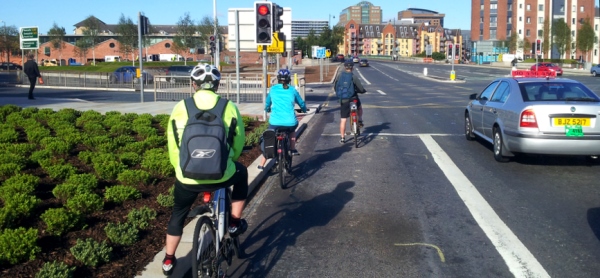
Belfast commuter cyclists are fully aware, each day, of how valued they are on our roads – we see this in lack of infrastructure, dangerous junctions, and blocked cycle lanes. If Roads Service and the Department for Regional Development, and disappointingly the Committee which scrutinises their work, are not open to these concerns, where do we go?

With this in mind, the date for Reclaim Belfast’s Cycle Lanes 2 will be the week of 5th November 2012 – bigger, better, and a louder voice? Let’s see what we can do..

That briefing in full

You can also listen to the cut short briefing on the NI Assembly website (file 4, 26:00 onwards)

Thank you Chairperson, and I’d like to thank the Committee for the invitation to present this briefing today.

By way of explaining the origins of the survey, I’ll start with a little background on the NI Greenways blog. I started compiling it in April this year as a way of highlighting opportunities to open around 600 miles of disused former railways across the province, in the model of the Comber Greenway. My intention is to raise local awareness by mapping these potential traffic-free walking and cycling paths for commuting, leisure and tourism, and as a resource for Northern Ireland to combat our worsening obesity problems.

As a commuter cyclist in Belfast for over 10 years, the social media connections I made through this blog brought me to discussion on the daily issues people face cycling to work on our roads. Alongside criticisms of lack of quality infrastructure, and general physical dangers, the major gripe was around cycle lanes in Belfast being blocked by parked vehicles.

My own route has what’s termed as an advisory cycle lane running for 800m, yet every night during urban clearway operation it is blocked by anything from 10 to 30 vehicles. In June I raised a complaint with Roads Service, but received a less than encouraging response. In the 12 months to April, just 11 Penalty Charge Notices were issued on the affected section of my commuting route. To my experience, and as the survey would later bear out, this is the level of illegal parking per night. Roads Service informed me that records are not kept of deployment of patrols per road, leading to obvious questions about how they evaluate the level of illegal parking across the city, and therefore the effectiveness of patrol deployment.

The idea for a city-wide survey came from Mark Tully, a lecturer in Public Health at Queen’s University, who unfortunately cannot be here today due to a prior commitment.

Put simply, we could draw on the time and experience of commuter cyclists to record the number of illegally parked vehicles in cycle lanes, and bus lanes, during their morning and evening commutes. Safety was paramount and volunteers were encouraged to mentally note the figures, and jot them down at the end of their journey. Volunteers were also reminded not to challenge or single out people who were illegally parked, to avoid any unhelpful confrontation or aggravation. Some participants also took cycle camera video recordings both as evidence of the accuracy of figures, but also to allow our unique point of view to be experienced, and some footage is available to view through the blog.

We set the survey for 5 working days on the week beginning 23rd July, and managed to get 9 volunteers. It should be noted that 4 of the participants were female, not a bad percentage for the survey, given that 2001 census figures put female cyclists at just 0.2% of all commuters in Belfast.

At least one arterial route in each geographic quarter of the city was covered.

After analysis by the team at Queens, the results for 69 qualifying journeys were released in the report which you all have a copy of. For a typical journey in Belfast, a cyclist will face 5 illegally parked vehicles blocking restricted lanes, or 4.5 for every kilometre of the city’s cycle and bus lanes. The worst performing route was the Springfield / Grosvenor Road corridor, with 26 vehicles illegally blocking cyclists on a typical journey.

Evening journeys were worse than mornings – typically 6.2 per km or 7 per journey during evening rush hour against 2.9 per km or 4 per journey in the morning. It’s difficult to draw conclusions about this difference, but some of the factors at work may be more shopping trips to local stores on the way home, better driver understanding of bus lane rules, and driver confusion over the operation of the relatively new phenomenon of advisory cycle lanes on urban clearways.

The survey puts clear evidence of this problem into the hands of frustrated commuters – it’s not just another grumble about our roads which can be easily dismissed.

Why does any of this matter? The frustration of commuter cyclists is not due to any sense of entitlement to this road space but rather from the perception and experience of increased road danger which illegally parked vehicles create. Cyclists have to filter in and out of general traffic unnecessarily – the Committee will understand this is about to become a source of increased danger as we approach the winter months and dark journeys home.  Each parked vehicle is a potential door opening accident risk. Road sides which should be clear have illegal visual obstacles increasing the risk of crossing pedestrians coming into conflict with other road users. As we’re the slowest road users, mixing with general traffic leads to pressure on cyclists and many dangerous overtakes by equally, and perhaps understandably, frustrated motorists.

Recently released PSNI road casualty figures show a jump in cyclists killed or seriously injured in Northern Ireland, 49 in each of the last two years against a baseline measure of 28. Looking at the trends for all road casualties, road safety has significantly improved in Northern Ireland over the past 10 years, with casualties for drivers, passengers, pedestrians and motorcyclists all down. Cyclists are the only group to with an upward trend in casualties, a worrying and underreported development.

Just last week one of the survey participants was involved in a road collision with a car crossing a cycle lane through stationary traffic in Belfast. If they had been driving a car, this would have been a minor prang with insurance details swapped – it landed the cyclist in A+E and wrote off their main form of transport – luckily and importantly, no lasting damage was done to the cyclist. We are among the most vulnerable road users, and taking steps to eliminate a fairly straightforward problem such as illegal parking can make a big difference to the experience and safety of cycling in Belfast.

What should concern the Committee, and all road users in Belfast, is that cycle lanes which are blocked every day at rush hour represent wasted public investment. We have notional targets to increase cycling levels in Northern Ireland, yet when paint is put down to mark out a city cycle network, regardless of how fractured and inadequate it remains in reality, cyclists are unable to use it. It fails to provide the separation of transport modes it sets out to achieve, fails to improve safety for all road users – in fact does the exact opposite while this problem persists. And crucially fails to properly sell the benefits of an alternative, yet viable form of commuter transport in our small city.

To put Northern Ireland’s cycling under-investment levels into perspective, in 2010-11 just 0.16% of Roads Service budget was put into cycling measures,

CUT SHORT

or 18p per head of population. Compare this against The Netherlands where €30 per head is spent. Maybe it’s an unfair comparison to make – on another day I’ll make a forceful argument about increasing our spending on cycling – but how can we start that debate when our 18p is going down the pan?

The survey group contacted Minister Kennedy to highlight the report, and we received a letter from Roads Service, and Committee members should have a copy in their briefing papers. The resounding verdict from participants was that the response was inadequate given the nature of the issue raised. To receive an, albeit informal survey report, yet backed by analysis from Queen’s University, and to respond with five long paragraphs explaining what a cycle lane is, felt somewhat patronising. [Read that response in full here]

Indeed the letter became a little surreal when Roads Service stated that cycle lanes mean “cyclists effectively have their own road space. This makes cycling safer, and at times of congestion, allows cyclists to make time savings”. This is quite an absurd statement given the report which prompted the response. There was no acceptance that illegal parking is a major problem for cyclists, or that Roads Service bears some responsibility for ineffective enforcement.

What was encouraging from the response are the changes proposed under the new contract with NSL, which Committee members have heard about from Ciarán de Búrca and the Minister in the past few weeks. The new protocol and associated awareness campaign should go some way to tackling illegal parking. The new tow and clamp policy, while potentially seeming like another stick to beat Belfast motorists with, will probably sharpen minds in the short term. These and other measures are to be welcomed as evidence of proactive traffic management. But, there is still one major worry running through from my initial complaint, to the survey, to the official response, and the new NSL contract.

That is resourcing, and deployment – Roads Service steer clear of this point in correspondence, yet it is at the heart of the problem.

Where parking wardens do not patrol, illegal parking will take place. As a prime example, I took to the Cregagh Road during the survey week, along with an onboard video camera. My typical journey across that week had 9.5 illegally parked vehicles, except for Wednesday when there were just 3. The reason? Two NSL parking wardens patrolling the road. I doubt they needed to issue many tickets, but the mere presence of high visibility enforcement was enough to practically clear the road.

So, new towing trucks to move illegally parked vehicles – great. How many trucks? How will they be deployed? Will the current priority system remain in place, with constant patrolling of the Lisburn Road, and sporadic to no coverage elsewhere? The committee heard from Lisburn Road Traders last week, and I’ll add this one point to their criticisms – having 27% of all Northern Ireland’s clearway related tickets, on just one Belfast Road, is actually a damning indictment of the spread of enforcement across our city, especially given that it’s an arterial route supported by both the railway and motorway network.

Will there be more than the current 1 or 2 car-based warden teams, and 4 or 5 teams on foot, for a city of around 20 main road corridors? Will Road Service commit to providing a better level of service across the whole of the city, or will the status quo remain? Certainly since my original complaint in June, and 11 weeks since the survey report, my rush hour journey has not had a clear cycle lane on one evening – not one.

To conclude, all available evidence shows that cycling levels are rapidly rising in Belfast. Roads Service’s own figures from Belfast cycle counter locations show a 152% increase in cycle usage from 2000 to 2010. The DRD Travel Survey for Belfast commuters showed an increase in people declaring a bicycle as their ‘usual’ form of transport from 1% 2000-2002 to 3% 2008-2010. We now number in the thousands during rush hour across the Belfast, and if good, safe infrastructure can be maintained and promoted, people will choose to make the switch to the bike.

The volunteers, and other commuter cyclists who’ve supported us since the report, will monitor progress on this issue very closely. I appreciate the Committee’s time this morning.

Cycling KSI rates are rising in Northern Ireland

Official statistics in Northern Ireland appear to show a worrying trend in road danger. Headline figures show overall rates of people killed, seriously or slightly injured on Northern Ireland’s roads continue to drop. But one group of road users is facing rising casualty rates – cyclists.

Any death on our roads is one too many, and behind the headline grabbing figures, many more people suffer minor or serious injuries each year travelling in Northern Ireland. Government bodies such as Department for Regional Development (DRD), Roads Service, the Department of the Environment (DOE) and the Police Service of Northern Ireland (PSNI) work hard to create safer road conditions and awareness of road user behaviour which causes accidents.

Recently released figures from PSNI showed that in 2011 there was a slight reduction in road casualties, a 2% annual drop to 8,760. There were 59 fatalities in 2011, a slight rise from 55 in 2010 which was the fewest number since records began in 1931. Wesley Johnston analyses why, despite great reductions over the last few decades, people are still dying on our roads.

What grabbed the attention was a sharp increase in cyclists casualties, an annual rise of 19% to 255 in 2011. The only other group to show a significant annual increase was pedestrians, up 13% to 834.

Looking at two years in isolation doesn’t give an accurate reflection of road safety, so to find some more general trends, I took the Police Recorded Injury Road Traffic Collisions and Casualties figures for ten years from 2002 to 2011 for pedestrians, drivers, passengers, cyclists and motorcyclists. To give some context to the figures – factoring in changing travel patterns – I added data from the DRD Northern Ireland Travel Survey for the same modes, showing miles and journeys per person per year from 1999-2002 to 2008-2011. The travel survey is based on a rolling 3 year average – I matched the latest year to the same year for the PSNI figures eg 2011 road casualties against 2009-2011 travel levels and so on.

The figures appear to show a worrying trend in Northern Ireland – while overall safety continues to improve, the situation for cyclists seems to be deteriorating.

Cyclists

Cyclists in Northern Ireland appear to be the only group with a strong upward trend in casualties over the last ten years. This is coupled with a rise in the average miles cycled per person per year, yet it is difficult to draw a conclusion that the two are directly linked, especially when the opposite appears true for drivers.

Pedestrians

Pedestrian casualties have fluctuated over the last decade, with an upward trend from 2005, but overall the figures remain generally constant. What is perhaps more concerning is the steady decrease in the number of walking journeys people are taking.

Motorcyclists

The figures for motorcyclists throw up some interesting points. From 2006 there has been a marked decrease in miles per person per year, coupled with a reduction in number of journeys. Someone with more insight into motorcycling may have an explanation for this, but it may be that the downward trend in casualty rates is more to do with less motorcyclists on the road than anything else.

Drivers

The bigger success stories in road safety are accounted for by drivers and passengers. We see that driver casualties remain in a downward trend over the decade, despite miles travelled per person per year increasing over the same period. Naturally much of the focus of DOE Road Safety campaigns has been on drivers, and the causes of accidents, and it appears some progress is being made.

Passengers

Passenger casualties, like that of drivers, continues a downward trend over the decade. But both indicators for travel show a decrease as well – what is most interesting here is the suggestion that there may be a shift away from shared travel to individual travel, but this is only speculation at this level of detail.

Why is cycling bucking Northern Ireland road safety trends?

This is the worrying question which needs better analysis than I can provide. The two strongest upward trends for miles and journeys are for drivers and cyclists, yet the casualty figures are sharply divergent for these two groups. If it is true that cycling is becoming a more popular form of travel in Northern Ireland, then this may explain some of the rise – more cyclists = more accidents.

There is also the question of whether government is investing enough to match rising cycling rates. In 2010-11, Roads Service expenditure on cycling measures as a proportion of the total roads budget was just 0.16%, against a general modal share of about 1% (NI) or 3% (Belfast). If the figures and commentary presented above pass scrutiny, it raises difficult questions on Northern Ireland’s commitment to cycling as a form of transport, and the understanding of the dangers faced by cyclists on our roads.

The forthcoming Active Travel Strategy for Northern Ireland contains an ‘aspiration’ to increase cycling levels to 1.5% by 2020 (I know), but to achieve this may require a large urban centre such as Belfast to double its cycling levels. It is not unrealistic to suggest that Belfast may come close to a 10% modal share by 2020, but do our road planners and politicians have any idea what a 10% share would look like on our streets, especially if the current poor infrastructure provision is not addressed?

Arguments about road space reallocation are fraught with controversy, as we have seen with Belfast On The Move, and it may be unrealistic to call for sweeping changes at present, given the tiny proportion of modal share. But if cycling rates continue to rise in line with expectations, aspirations and the upturn we see every day, and government has no plan or inclination to invest in cycling-focused infrastructural safety improvements, cycling casualties may continue to rise.

In July 2012 Belfast cyclists joined together to highlight the problem of the city’s blocked cycle lanes. QUB researchers analysed the data from 69 journeys, with a typical commuter trip blocked 5 times, or 4.5 illegal blockages per km of supposedly parking-restricted lanes. The issue was highlighted in the media, to politicians, the Regional Development Committee at the NI Assembly and DRD / Roads Service. Now that Roads Service have provided their response it’s time to review a busy month for the Reclaim Belfast’s Cycle Lanes report.

Blocked cycle lane

The media response

The story was picked up by two big fish in the local newspaper market, the Belfast Telegraph under the headline Cyclists demand action on illegally parked car chaos  and also in the Irish News with their story Cycle lane investment ‘wasted public money’. In particular the Belfast Telegraph’s comments sections provided a great opportunity for feedback and discussion, and 40 comments here showed the depth of feeling – worth a read!

The lovely people at View TV Belfast ran with a report Cycle lanes a waste of public money including some actual survey footage from the Springfield Road, coincidently the worst performing road in the survey.

NI Greenways  somehow managed to blag its way on on to Radio Ulster’s Talkback show, where even black taxi drivers were phoning in to support cyclists!

Fortunate timing allowed the report this media space on its own merits, ahead of the two big roads issues of the past month, the taxis in bus lanes consultation and the growing pains of the Belfast on the move project.

The Twitter response

Debate on Twitter was lively as always, with generally positive comments on the survey and the potential of making a real difference to all road users. Some of the comments:

https://twitter.com/SteveLimmer/status/240468998544818176


https://twitter.com/DerSchwarzBaron/status/240825547607920641


https://twitter.com/ctokelly/status/239810163345870848

The political response

So far so good, but this report was designed with the sole purpose of making a real difference to the experience of commuter cyclists in Belfast. So the press releases were simultaneously sent to all Belfast City councillors (those with an email address), all MLAs from Belfast constituencies, the members of the Regional Development Committee at Stormont and DRD Minister Danny Kennedy.

The response, perhaps unsurprisingly, has been sluggish. Belfast councillors expressed the greatest interest in the report, with follow up questions and suggestions of a meeting – clearly with an eye on the Belfast Bike Hire announcement just days before. But just seven councillors from 45 contacted felt moved to respond.

Only six MLAs from 35 contacted have responded, with just one MLA following up with any real action – it doesn’t take a genius to figure out which MLA that was. Assembly questions have already been raised on the report, and answered (sort by Regional Development). The Regional Development Committee noted our correspondence on 12th September, and on the same day even began to question DRD’s Ciarán de Búrca on illegally parked cars! There is yet hope!

The Roads Service response

The private office at DRD deferred to Roads Service Eastern Division for comment, and the full text is attached below. To summarise the main points:

  • Roads Service appreciates cyclists’ concerns
  • A new contract with NSL for parking enforcement will see changes
  • An awareness campaign on parking “Dos” and “Dont’s” will be launched to support a new protocol
  • Enforcement will move to ‘tow and clamp’ from early 2013

While these are interesting developments, the response itself is very disappointing. It reads like a stock response to a complaint from a member of the public. Despite five long paragraphs on the finer points of Belfast’s cycle infrastructure, the strange emphasis on mandatory lanes leaves the impression that Roads Service didn’t fully understand (or perhaps even read) the survey report. The vast majority of illegally parked cars recorded in the survey were on advisory cycle lanes during urban clearway operational hours, and clearly these rules are the most confusing for all categories of road users.

The report drew a clear conclusion that Roads Service failure lies in “inadequate parking enforcement coverage”. Roads Service and their NSL contractors have all the necessary legal instruments in place to enforce parking restrictions – it’s just that the resources to cover all of the city’s main roads during rush hour are not being made available. As this video comparison from the survey week shows, mere visibility of traffic wardens is enough to clear arterial routes of illegal parking. Roads Service completely ignores this criticism.

Indeed, while new measures are being brought in, to what extent will they cover the whole of the city? A tow truck risks adding to the impression of motorists being beaten with another ‘stick’, as seen with the current city centre bus lane controversy. But is it one truck or two, or more? If the new towing policy can only cover the same number of routes as are presently patrolled by wardens, the situation on cycle lanes may not materially improve.

So no acceptance that illegal parking is a major problem for cyclists, or that Roads Service bears some responsibility for ineffective enforcement. Just a very bland corporate line that Roads Service’s advisory cycle lanes mean rush hour “cyclists effectively have their own road space. This makes cycling safer, and at times of congestion, allows cyclists to make time savings” – a stunningly absurd statement given the report which prompted the response.

What the traffic wardens say

You learn more about the actual situation in Belfast by talking to traffic wardens. They report that perhaps five teams at most work the rush hours on arterial routes, with one or two “mobile” units with access to a car. Look at the map and make your own judgement on how many Belfast roads count as ‘arterial’, but somewhere between 14 to 22 urban roads carry clearway restrictions, many with advisory cycle lanes. To ensure a ‘spread’ of traffic wardens, priorities for coverage are assigned on a week-to-week basis. Lisburn Road is always priority #1 (which goes some way to explaining why 27% of all parking tickets in Northern Ireland are issued here) with the Newtownards Road usually a close second in importance.

If your commuter route is elsewhere, good luck to you – coverage is patchy or in some cases almost non-existent. This explains why some roads are blocked every day – many drivers are either unaware there are restrictions or have never encountered a traffic warden who might tell them otherwise.

Traffic wardens are also having fun with some new training being rolled out to volunteers – on how to use a moped. Yes, apparently 12 moped-riding red coats will form part of the new NSL arrangements in 2013, which leads me to wonder if this is evidence of people actually reading my blog?

From here to where?

While there has been a small yet significant response to the report, it highlights the problem of so many previous cycling awareness or campaign initiatives in Belfast. Alone it’s an interesting piece of work, which quickly fades from the view of a disinterested body politic. Only by keeping the pressure on at the relevant levels can Belfast commuter cyclists hope to effect real change to an issue that causes increased physical danger, greater general traffic congestion, and discourages cycling uptake.

With that in mind, the most effective way to keep the issue high on the agenda is to run the survey again – bigger and better. If you’re interested in becoming a participant, and helping us the achieve the goal of 100% coverage of Belfast sometime in the next few months, contact NI Greenways by email or on Twitter @nigreenways.

Thanks again to all the commuter cyclists who participated in Reclaim Belfast’s Cycle Lanes, whether cycling the routes and recording data or helping to spread the message in the media or on social networks – and huge thanks to Mark Tully and his team at QUB for the main analysis.

That Roads Service response in full

I appreciate your concerns regarding the frustration caused to cyclists by vehicles that park within bus and cycle lanes during their operational hours. Perhaps it would be useful if I first outlined the type of facilities and the restrictions that apply to them.

Bus lane restrictions derive from specific legislation and prohibit the use of lanes by private cars, vans, lorries etc, during their hours of operation. Any infringements involving prohibited vehicles parking in those lanes are enforceable by Roads Service, through its contractor, NSL. Infringements involving moving vehicles within these lanes are enforceable by the PSNI.

Cycle lanes may be either advisory (which do not have supporting legislation and are not therefore enforceable) or mandatory (which have supporting legislation and are enforceable, similar to bus lanes as above). Advisory cycle lanes may be on roads that are subject to other restrictions, such as urban clearway restrictions, in which case those restrictions also apply to the cycle lanes.

We would normally use advisory lanes on roads with urban clearway regulations, so that when traffic levels and the number of cyclists are at their highest, cyclists effectively have their own road space. This makes cycling safer, and at times of congestion, allows cyclists to make time savings over those using vehicular modes.

During times when traffic levels are at their lowest, and the urban clearway restrictions do not apply, it is legally permissible to park on/across advisory cycle lanes. During these off-peak times, the levels of traffic and cyclists are at their lowest and it is therefore considered that cyclists can successfully share the remaining roads space. This arrangement is intended to provide the best balance between the needs of cyclists and the adjoining businesses/properties.

Mandatory cycle lanes (which would be marked by solid white lines) would provide a clear route for cyclists and would also restrict vehicles, subject to certain exceptions, from pairing along the road. However, the introduction of waiting restrictions, or mandatory cycle lanes, can be a contentious issue and would generally lead to a displacement of parking, often to other locations that are less able to accommodate it, such as residential streets in the general vicinity. Therefore, Roads Service does not generally use mandatory cycle lanes on roads with a mixed business/commercial/residential frontage.

Roads Service’s new parking enforcement and car park management contract with NSL Ltd will commence on 30 October 2012. In advance of this we plan to run a parking enforcement awareness campaign.

This will include the distribution of information leaflets to drivers to remind them of the importance of parking restrictions and the benefits of effective parking enforcement. The leaflet will include a number of “Dos” and “Don’ts” for drivers, advising them of where they should and should not park and it will clearly inform drivers not to park in mandatory cycle lanes.

Roads Service will also be publishing a parking enforcement protocol to provide the public with detailed information on the various parking contraventions that can be enforced by traffic attendants. This will also include information specific to mandatory cycle lanes.

Additionally, Roads Service has decided to change its enforcement policy in relation to illegally parked vehicles on bus lanes and urban clearways. Currently any vehicles parked in a bus lane or on an urban clearway will only receive a parking penalty, meaning the lane is still blocked to traffic. Following the introduction of the new contract Roads Service will also remove vehicles that are illegally in these lanes so freeing up the lane. It is hoped this change will be introduced in early 2013.

Any politician will tell you they’re concerned about road safety, the environment and health, or can point to their party manifesto for clear policies on cycling issues. But what are your MLAs actually doing about improving cycling in Northern Ireland? We’ve compiled and analysed the 78 cycling related Assembly Questions asked since the last election.

Cycling up at Stormont

So you use a bike to get between home and work in Northern Ireland, or maybe pop to the shops with a basket on your handlebars. You’re frustrated by a lack of cycle lanes, or no bike parking facilities, or think the roads are too dangerous. You can’t take your bike onto the train in the morning so you end up driving to work instead. What do you do about it?

Continue reading “Cycling on the agenda at the Northern Ireland Assembly”