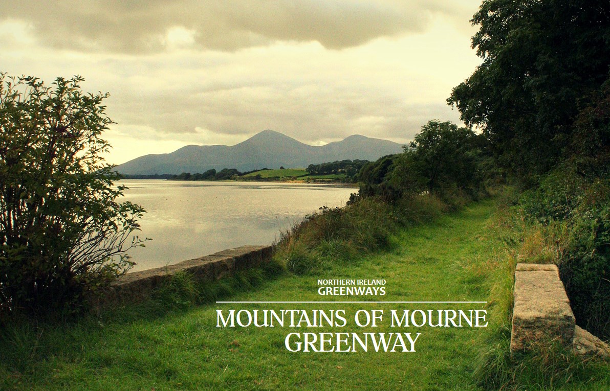
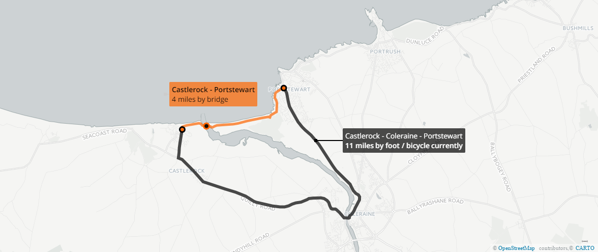
Bridging the divide is a series of articles proposing three investments which can boost active travel by linking communities divided only by the cost of a bridge. As the River Bann flows into Lough Neagh, a former crossing point has fallen into memory – now a traffic-free bridge could link more than just two small settlements, it could complete a missing link in tourist trail surrounding Lough Neagh.
Bannfoot Bridge
Bannfoot is a small village situated by the point where the Upper Bann meets Lough Neagh. The sleepy scene which greets visitors today betrays the historic importance of this waterway to the economy of this part of Ireland.
![Raymond Okonski [CC BY-SA 2.0 (http://creativecommons.org/licenses/by-sa/2.0)], via Wikimedia Commons](https://commons.wikimedia.org/wiki/File%3ABannfoot_Ferry_(West)_-_geograph.org.uk_-_568703.jpg)
“Before the modern improvements on roads and wheel carriages, this navigation was of more value than it appears at the present time.”
A Nimmo, Tidal Harbours Commission, Appendix, 1846
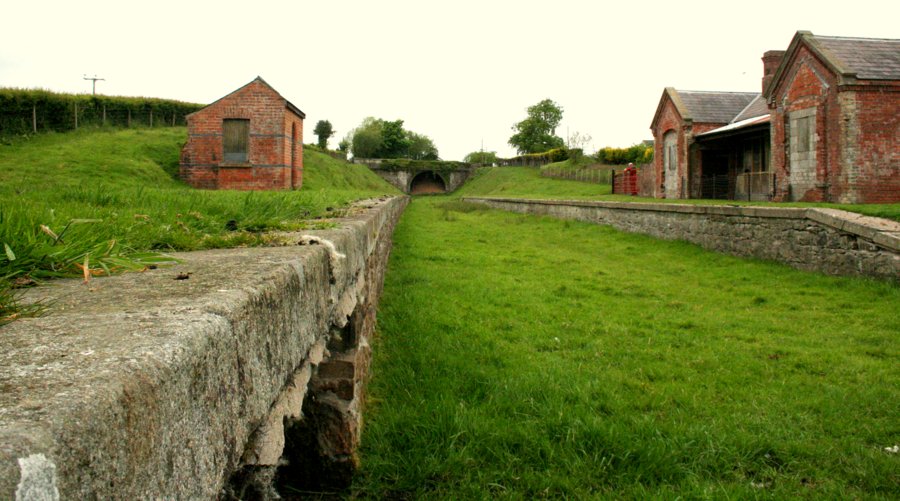
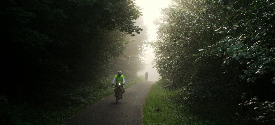
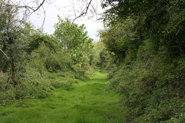
The canal (which has long fallen into disuse and disrepair, and is better known these days as a popular ‘greenway’ route) was for a time a key economic corridor in north-east Ireland.
![By Albert Bridge (http://www.geograph.ie/photo/898688) [CC BY 2.0 (http://creativecommons.org/licenses/by/2.0)], via Geograph.ie](http://nigreenways.com/wp-content/uploads/2017/02/geograph-898688-by-albert-bridge.jpg)
“The Newry Canal, located in Northern Ireland, was built to link the Tyrone coalfields (via Lough Neagh and the River Bann) to the Irish Sea at Carlingford Lough near Newry. It was the first summit level canal to be built in Ireland or Great Britain, and pre-dated the more famous Bridgewater Canal by nearly thirty years and Sankey Brook by fifteen years.”
Inland Waterways Association of Ireland
The route from Lough Neagh through to Newry – which links with the Ulster Canal through Coalisland into Armagh, and the Lagan Canal to Belfast – began at Bannfoot.

Bannfoot (originally called Charlestown) has been a crossing point for centuries. A ferry is mentioned at least as far back as 1760 and a ferry service operated up until 1979 – that’s more than 200 years of recorded daily crossings.
The NI Screen Digital Film Archive has a delightful 8mm colour film by John Stevenson, a businessman from Portadown, showing how the ferry moved passengers and (very brave) car drivers between the banks.
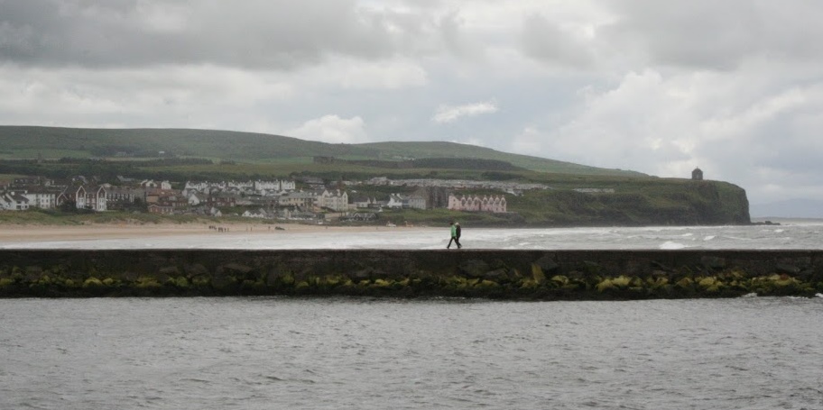
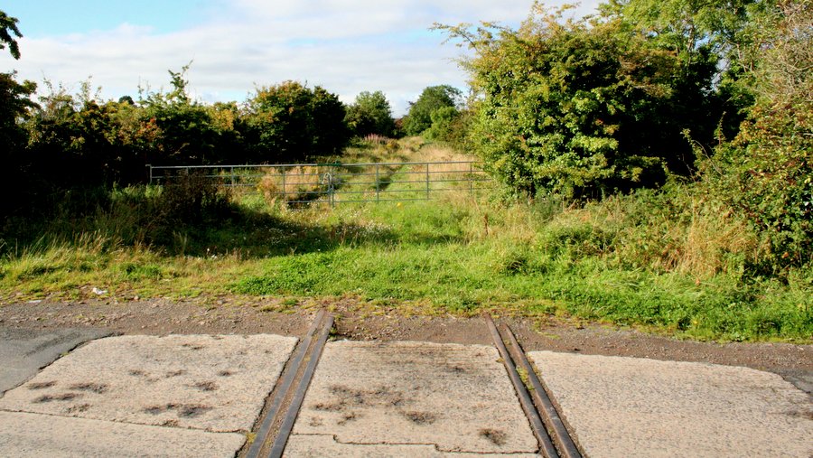
However, today the Bannfoot Ferry’s jetties stand silent, and point to the anomaly of the Upper Bann – it’s the only river anywhere on the shores of Lough Neagh which isn’t immediately spanned. The river meanders for a good 9 miles through the County Armagh countryside until it encounters a pedestrian-friendly bridge in Portadown.
[youtube https://www.youtube.com/watch?v=Ov-wv5dkfQA&w=900&h=506]
The anomaly is stark when you look at the disconnection between neighbouring communities. Maghery and Bannfoot lie just three miles apart along the line of the Columbkille Road. But to get from A to B requires a shocking round trip of 18 miles by bicycle, or 16 miles by car using the motorway.
Public transport is an option between Maghery and Bannfoot, but it’s not for the faint-hearted. Translink’s website gives only three journey options on a weekday, the quickest involving an eye-watering four buses taking one hour and 58 minutes. That may be seven minutes shorter than the quickest Belfast to Dublin train service, but the Enterprise is travelling over 100 miles rather than our three miles in question.
A permanent Bannfoot crossing is unfinished business – the missing piece of the jigsaw in the (currently) 113 mile Loughshore Trail which uses mostly traffic-vacant country roads. A pointed reference is made on the Cycle NI website:
“This route does not follow along the Lough all the way, it veers off further away from the Lough passing through the town of Portadown, crosses the River Bann and back up again towards the Lough heading to Kinnego.”
A similar traffic-free bridge in Maghery was installed in 2007 which turned an eight mile diversion to Tamnamore and back into a joyous skip (or pedal) over the River Blackwater.
Took this yesterday evening, the River Blackwater foot/cycle bridge linking Armagh & Tyrone at Maghery pic.twitter.com/dE74oXKdTC
— Martin McAlinden (@dr_urbanus) July 23, 2014
There is potential for modal shift – albeit very slight – but it does leave Lurgan, Lisburn, Belfast within striking distance from the south-west corner of Lough Neagh. The car trip from Maghery to Lurgan using the motorway is about 20 minutes – the equivalent cycle over a Bannfoot Bridge would be just 50 minutes.
Stephen McNally, one of the organisers of the popular Lap the Lough event, thinks the bridge would be transformative for the area:
“It would be a much safer, quicker, quieter and picturesque crossing than navigating through Portadown town centre.
“There are over 20 cycle clubs within 20 miles of the Bannfoot area and probably a further 50 clubs within regular striking distance but none venture this way because crossing isn’t an option… cyclists like a loop. Potentially that’s 5,000+ regular cyclists of all ages, abilities, backgrounds, including youth & families who could be crossing at the Bannfoot producing no emissions, no noise and no impact to the roads or the local community.
“I understand there may be concerns from local residents but they can look toward the bridge at Maghery, operating now for 10 years. It’s been transformative for the area with walkers, cyclists and anglers crossing daily and no negative impact whatsoever.
“A footbridge at Bannfoot would make the Loughshore Trail a much better proposition for tourists too – like many local cyclists they’ve had to deal with the incredulity of cycling to the Bannfoot expecting a bridge – there’s permanent proof with one sorry fellow on Google Maps shown turning back in dismay.
[googlemaps https://www.google.com/maps/embed?pb=!1m0!3m2!1sen!2suk!4v1486137696759!6m8!1m7!1s3x7YVGlt5avZTj-i0CxGWQ!2m2!1d54.50502978798802!2d-6.516181506531012!3f255.14726252518457!4f-11.123631288254515!5f1.4451984386336232&w=900&h=450]
“It’s a time for building bridges and closing divisions both geographical and historical – I think the appetite is there.”
Enhancing a great local cycling network
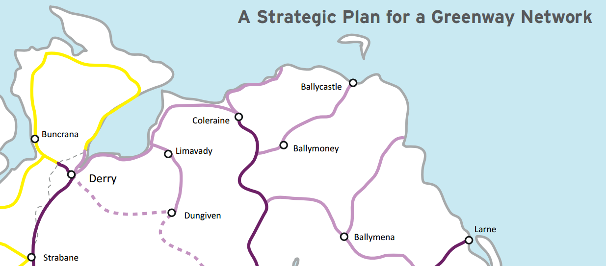
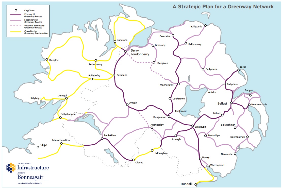
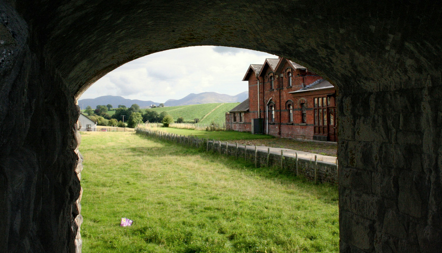
While the Department for Infrastructure’s Greenway Network Plan only includes the main Coalisland – Dungannon – Portadown – Lurgan route (follow it in yellow in the picture below) the original NI Greenways vision map included consideration of opening up the historic canal routes closer to Lough Neagh.
The potential for cycling around this area is immense – linking quiet country roads to the existing Broad Water four mile path near Moira to the west, the existing Coalisland Canal Towpath to the east and perhaps a fully reopened Ulster Canal south towards the Fermanagh lakes and the island-wide inland waterway network.

It’s also within the orbit of the best urban cycling network in Ireland – the Black Paths which weave their way through Portadown, Craigavon and Lurgan, giving area residents virtually traffic-free access to the Rushmere Centre and back.
There may be another way to look at the current mad diversion though Portadown – it brings cyclists into contact with heavy traffic on the congested Bann bridge. Outside of Belfast and Derry, the Portadown / Craigavon / Lurgan area has the most reported cycling collisions in Northern Ireland.
Connecting local rivals
Two GAA clubs play on either side of the Bannfoot crossing – 2016 Armagh Senior Football Champions Maghery Sean MacDermott’s and High Moss Sarsfields GFC in Derrytrasna. The direct road with the addition of the Bannfoot Bridge would put exactly 5 miles between the two clubs. But it takes a 16 mile trip through Portadown by car for the several age groups from the senior teams to the under 14s to play the fixture at either ground.
Armagh League 1st Division Sarsfields vs @MagheryGAC
Friday 4th July
Final Score Sarsfields 0-9 Maghery 0-8 pic.twitter.com/ojEKJoq6Jk— Sarsfields PRO (@SarsfieldsPRO) July 7, 2014
The bridge would enable players and families from the whole area to cycle and walk between the grounds for matches – saving a lot of petrol and adding the possibility of group cycles from one ground to the other. The bicycle trip between the grounds would actually be quicker than the car trip through Portadown – another example of why the bridge is a no-brainer?
Charlie Monaghan, Chairman of the Lough Neagh Partnership said of the bridge concept:
“We would very much welcome the development of the Bannfoot Bridge as it would lead to the linking of communities along the southern shore of lough Neagh”.
The Bannfoot bridge is an opportunity to celebrate our industrial heritage with a permanent crossing at this point of historic significance. It would restitch and strengthen natural links between the communities of the Loughshore in two artificially and unnecessarily remote area. A cycling cafe could do roaring trade with the potential passing pelotons, and tourists would find even more reasons to visit this beautiful area.
What do you think of the Bannfoot Bridge idea? Please take the time to leave your comments below and share through your social networks. Election season is a great time to contact your local MLA candidates to ask for their support!
(Note – many thanks to the organisers of The Fréd Festival for highlighting this particular idea!)
![By Clifton Cartwright (Desann) (http://art.gnome.org/backgrounds/nature/2524) [CC BY 2.0 (http://creativecommons.org/licenses/by/2.0)], via Wikimedia Commons](https://commons.wikimedia.org/wiki/File%3ASyltBoardwalk.png)