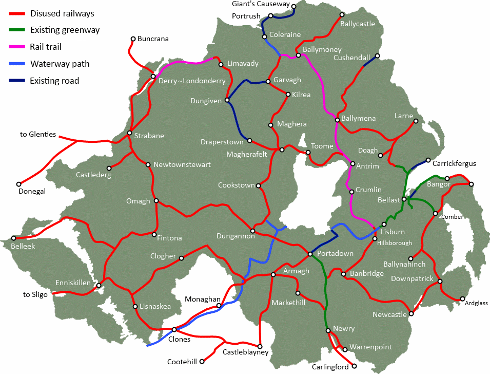
Potential exists to construct a Greenway from Toome to Magherafelt, on the disused trackbed of the former Belfast and Northern Counties Railway. This important link in an orbital traffic-free path around Lough Neagh could bring valuable tourist spend to Toome, Castledawson and Magherafelt.
The proposed Greenway route begins by linking with another suggested Greenway tracing Lough Neagh to Randalstown. Holding a straight line for the 4 miles to Castledawson, the route has remained mostly undisturbed as seen from satellite imagery. Occasional agricultural land development and industrial buildings encroach onto the former line, but slight alterations and landowner negotiations could resolve these issues.
View of Greenway stretching to Castledawson from Blackpark Road
[googlemaps http://maps.google.co.uk/maps/ms?msa=0&msid=202802535379582075161.0004bf8c869e93eefa0ad&ie=UTF8&t=m&layer=c&cbll=54.7632,-6.49869&panoid=_Q41AjmqcHrAONzXktVb7A&cbp=13,289.29,,1,7.76&source=embed&ll=54.743501,-6.498756&spn=0.069363,0.205994&z=12&output=svembed&w=600&h=350]
The route turns southwest as it passes through Castledawson. Simple alternative pathways using residential streets and new paths beside housing developments can see a continuous route maintained through the town. The path exits Castledawson and crosses the A6 at Mid Ulster Auctions site.
From here it’s a 2 mile journey to the end of the proposed Greenway. The usable space of the former railway terminates on the outskirts for Magherafelt, due to development since the railway was shut. Alternative routes into the town, whether on a winding traffic-free path, or upgrading the main road, should be considered.
[googlemaps http://maps.google.co.uk/maps/ms?msid=202802535379582075161.0004bf8c869e93eefa0ad&msa=0&hl=en&ie=UTF8&t=p&ll=54.761086,-6.527596&spn=0.059428,0.20565&z=12&output=embed&w=600&h=300]
There are great advantages to this Greenway route. Pedestrian provision is limited to a single continuous path on the Castledawson to Magherafelt road, and there no provision on the A6 – the main arterial route from Belfast to Derry~Londonderry. A 4 mile walk or cycle from Castledawson to Toome is a viable alternative to private car travel which is not being catered for, despite road upgrades over recent years.
Magherafelt could grow a healthy hospitality sector linked to increased active touring visits which could arise from a 600 mile Northern Ireland-wide Greenway network. Magherafelt sits at a former railway crossroads, and this could position the town as a hub of leisure and touring travel in Mid Ulster. Further posts will detail the links north to Maghera, Kilrea and Garvagh, west to Draperstown and south to Cookstown.
Building upon the good work of Sustrans in mapping the National Cycle Network around Lough Neagh, the former railway network presents a unique opportunity. Northern Ireland can develop a health-promoting and tourist-attracting fully traffic-free pathway network around Lough Neagh and beyond.
*Note for readers – click into the Google Map above, switch to Satellite, and you can explore the route close up. Many road crossings have Streetview available to see the route in greater detail.
History of railways around Lough Neagh on the Lough Neagh Heritage website