A new pedestrian and cycling greenway route through Downpatrick would link the historic town with Belfast, and provide a quality tourist trail from Northern Ireland’s captial city to the Mourne Mountains.
[googlemaps http://maps.google.co.uk/maps/ms?msa=0&msid=202802535379582075161.0004bea4e6d2981bee4d5&hl=en&ie=UTF8&t=p&ll=54.33094,-5.682678&spn=0.240231,0.822601&z=10&output=embed&w=600&h=300]
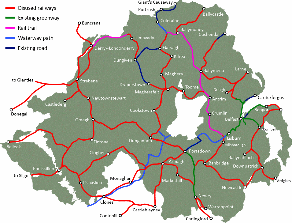
Connecting with the Comber to Ballynahinch Greenway at the former Ballynahich Junction, the route winds through wonderful County Down countryside . This is one of the most intact routes in Northern Ireland, with the vast majority of the rural sections clearly visible on satellite imagery. From Ballynahinch Junction to Downpatrick is just over 8 miles, passing through the town of Crossgar. Some simple upgrading work could easily provide a dedicated cross-town cycle route with some traffic-calmed sections.
County Down tourism
This completes a 25-mile traffic-free route from the heart of Belfast to Downpatrick, bringing the town within the orbit of day tripping leisure riders, and a key stop off for a tourist trail to the Mournes. The railway company was instrumental in developing the tourist market in the area, and a renewed Greenway through the heart of County Down could open new opportunities for tourist growth.
The route enters Downpatrick across the Quoile river, joining Northern Ireland’s only working heritage railway, the Downpatrick and County Down Heritage Railway. A link up with the heritage railway project is a fantastic oportunity to highlight a major tourist atraction, which can provide education on the history of the route of the new Greenway. Downpatrick itself boast Inch Abbey, Downpatrick Cathedral and the reputed resting place of St Patrick himself.
County Down National Cycle Network
The National Cycle Network continues from Downpatrick on-road to Strangford, with the local attractions of Castle Ward, the ferry to Portaferry, the Exploris Aquarium, the Strangford Peninsula and Strangford Lough itself.
The former branch line to the fishing town of Ardglass is a further 8 miles through farming country. This section has been developed to a greater extent, but local benefit could be derived from extending the Greenway network to the coast. There is an opportunity for renovation and renewal of a coastal bridge on the outskirts of the village, a direct path to the Coney Island Caravan Park, and a chance to further promote the area to users of the marina.
You can find information on the history of the Belfast and County Down Railway on the downrail.co.uk website.
*Note for readers – click into the Google Map above, switch to Satellite, and you can explore the route close up. Many crossing bridges have Streetview available to see the route even closer.
Next up: The Downpatrick to Newcastle Greenway.