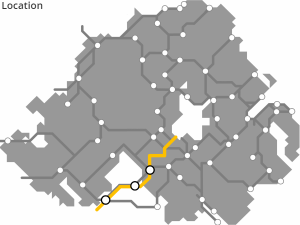
MAGHERY TO BELTURBET GREENWAY
“Ulster Canal Greenway”
The Ulster Canal weaved through counties Monaghan, Fermanagh, Tyrone and Armagh on its way between Upper Lough Erne and Lough Neagh. Partial restoration works have commenced as part of a long-term vision to reopen the navigation and, as part of that vision, pathways along the length are either planned or possible, linking all the way between Belturbet by Lough Erne and Maghery at Lough Neagh.
ROUTE DETAILS
| Length | 74 kilometres |
| Estimate | £11 million |
| Timescale | 2026 to 2040 |
| Type | Former canal |
| Title | Ulster Canal |
| Border area | No |
| Councils | Armagh, Banbridge and Craigavon Borough Council |
| Monaghan Councty Council |
IMAGES


PROGRESS UPDATES
Idea stage
Feasibility
Construction
Completed
RESOURCES ELSEWHERE
Ulster Canal Greenway (Monaghan County Council)
Ulster Canal Greenway (Waterways Ireland)
Ulster Canal History (Craigavon Historical Society)
Ulster Canal Greenway video (Special EU Programmes Body)
Good practice: Ulster Canal Greenway (Interreg Europe)
Disused Ulster Canal Is Proposed Greenway, Public Consultations Commence
Restoration of Ulster Canal Proves A Technical Challenge (Afloat)
£1.5m for Ulster Canal – shut to boats since 1931 (Belfast Telegraph)
Work delayed on first stage of reopened Ulster Canal (Irish Times)
Work set to begin on Ulster Canal (Irish News)
Assessing geotechnical constraints on the development of Ulster Canal Greenway Phase 2
Ulster Canal Cycle Trail (Cycle NI)
Ulster Canal Cycle Route (Sustrans)
Exercise Explore Enjoy: A Strategic Plan for Greenways (Department for Infrastructure) PDF 2.8MB
Strategic Plan for Greenways Base Report (AECOM, Sustrans, DfI) PDF 15.7MB
GREENWAY PROJECTS WHICH INTERSECT

A 26km route from Armagh through Killylea, Tynan, Caledon and Glaslough on the way to Monaghan town.
CALEDON TO MAGUIRESBRIDGE GREENWAY
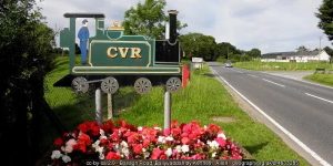
A 60km route following the line of the former Clogher Valley Railway and the succession of roadside railway stations still standing along the way.
COALISLAND TO MOY AND CHARLEMONT GREENWAY
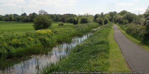
A 7km pathway along the side of the Coalisland Canal

PORTADOWN TO DUNGANNON GREENWAY
A 25km route starting up the ‘Derry Road’ from the existing railway station at Portadown across the Blackwater and into Dungannon.
GET INVOLVED
Successful greenway projects are driven by the passion of local people. If you have an update to share, a story to tell about the history of the route or future of the Maghery to Belturbet Greenway / Ulster Canal Greenway, or if you want to submit a picture or video to this page, please get in contact.