CRAIGAVON BLACK PATHS
“Craigavon Black Paths”
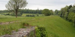
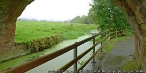
Not that well known outside of the Upper Bann area, but integral to the mini metropolis of Portadown, Lurgan and the ‘new city’ of Craigavon that stalled in its development, the Black Paths create a network of traffic-free routes of unparalleled density anywhere in Ireland.
ROUTE DETAILS
| Length | TBC kilometres |
| Estimate | Complete |
| Timescale | Complete |
| Type | Existing pathway network |
| Border area | No |
| Councils | Armagh City, Banbridge and Craigavon Borough Council |
IMAGES


PROGRESS UPDATES
Idea stage
Feasibility
Construction
Completed
February 2019: ABCBC seeks views on proposed greenways
RESOURCES ELSEWHERE
Capturing Craigavon – Black Paths
Craigavon’s Black Paths (PLACE NI, YouTube)
Craigavon City Park and Lakes (Outdoor NI)
Craigavon footbridges to get a £260k makeover (Lurgan Mail)
Trails of the unexpected around Craigavon lakes (Belfast Telegraph)
Walking & Cycling in Craigavon (Walk NI)
Exercise Explore Enjoy: A Strategic Plan for Greenways (Department for Infrastructure) PDF 2.8MB
Strategic Plan for Greenways Base Report (AECOM, Sustrans, DfI) PDF 15.7MB
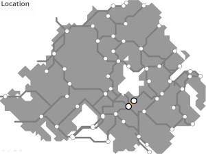
EXPLORE THE BLACK PATHS
March 2018: [JH] This map is still a work in progress (sorry!), please feel free to chip in..
GREENWAY PROJECTS WHICH INTERSECT
A 15km route from Portadown along the former Great Northern Railway line, passing by Richhill, to Armagh City.
Following the route of the Lagan Canal out from Lisburn to Lough Neagh and down towards Lurgan to form a 29km greenway.

A 29km towpath along the disused Newry Canal from Portadown through Scarva and Poyntzpass into Newry City.

PORTADOWN TO DUNGANNON GREENWAY
A 25km route starting up the ‘Derry Road’ from the existing railway station at Portadown across the Blackwater and into Dungannon.
GET INVOLVED
Successful greenway projects are driven by the passion of local people. If you have an update to share, a story to tell about the history of the route or future of the Craigavon Black Paths, or if you want to submit a picture or video to this page, please get in contact.