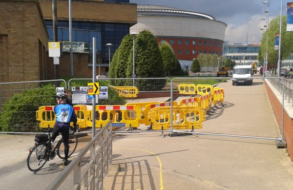
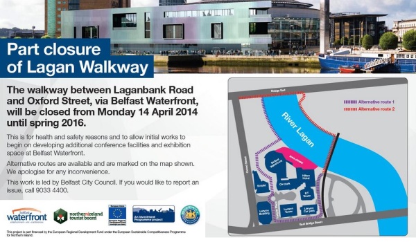
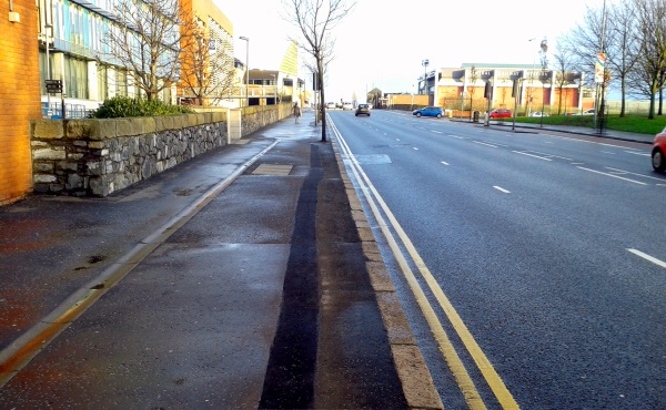
This week in Belfast, the western bank of the Lagan River Walkway closed for two years, to allow construction of a new Conference Centre at the Waterfront Hall. This path is the traffic-free walking and cycling spine of Belfast, part of the National Cycle Network, and crucial to the success of the city’s cycling revolution. So why isn’t the path being maintained through the works, and why are the proposed diversion routes not up to standard?
No sense of irony: Waterfront welcomes Giro, prepares to close Belfast's main cycling route for 2yrs pic.twitter.com/jk6dScVvJ3
— NI Greenways (@nigreenways) April 25, 2014
The Waterfront extension works were announced in January, part of a £29.5 million upgrade to attract international conferences and exhibitions. Disruption to the Lagan Walkway route was expected, as the new structure will overhang the pathway when completed. However, it’s understood diversions were decided before the main active travel body in NI, Sustrans, was consulted. So what were the options on the table for Belfast City Council?
Maintaining the route
It’s understood that following initial works to the edge of the river, the substantive construction work will take place closer to the existing Waterfront building for a significant period of the next 2 years. Providing a boardwalk right at the river’s edge, or perhaps even a pontoon, seemed like a viable solution for continued access during periods of low risk.
The river’s edge at the Waterfront includes an existing pontoon for boat access and a built-out viewing platform. A clever engineering solution (still) seems possible.
Questions need to be asked of Belfast City Council: was it their own Health and Safety assessment which ruled out this option, or did the contractors just inform them it didn’t suit?
Cycling debate @niassembly: @patsymcglone on @belfastcc's Waterfront shambles http://t.co/d4vuUAw2Ly pic.twitter.com/d0JDuBHH0Y
— NI Greenways (@nigreenways) April 29, 2014
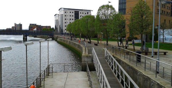
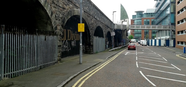
Alternative Route 1 (via Oxford Street)
Sustrans Ranger Ellen Murray knows NCN Route 9 very well, and has tackled the issue in great detail on her blog. She took a run along this diversion heading south to see the difficulties:
“This proposed route brings cyclists and pedestrians around the front of the Waterfront Hall, along a fairly ambiguous path which doesn’t feel like a contiguous route. It then brings users across a cobbled section (which is slippery when wet) across a minor roundabout, and then along a quite narrow stretch of Lanyon Place. The road is flanked on the left by a construction site, leading to poor visibility at corners.
This road is also significantly below the level of the adjacent East Bridge Street and is an intimidatingly dark route after hours which feels very isolated, which is likely to further affect cycle and pedestrian traffic using the route.
Rejoining the NCN9 route at the ramp alongside the railway underpass presents a significant conflict area for pedestrians and cyclists, who need to turn more than 90 degrees to continue along their journey. Along the whole proposed route, there are many crossing points for pedestrians, and a significant number of conflict areas for cyclists and pedestrians, who will now have to contend with Hilton Hotel traffic at the roundabout, and other local traffic along Lanyon Place.“
It also represents a significant detour, especially for those on foot. For anyone walking from the Albert Bridge or southern sections of the Lagan path, being diverted up East Bridge Street is a far more direct route, albeit with poor cycling connectivity to Oxford Street.
Better dedicated cycling facilities on East Bridge Street could have taken some of the strain during the next 2 years. Consideration should be given (as part of a developing cycling masterplan for Belfast) for a separate cycle path on the country-bound side.
Alternative Route 2 (The Bridges)
While a potentially shorter route, the mis-steps by Belfast City Council in rolling out this diversion have been amazing to watch. From first viewing of the map, you wonder if Belfast City Council ever bothered to check if cycling was legal on the tight, busy pedestrian footway on Queen’s Bridge.
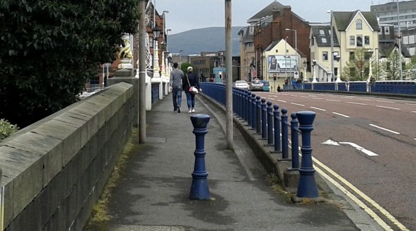
Clearly, with the generous allocation of ‘Cyclists dismount’ signage (alongside the highly embarrassing upside-down route markers) the penny had dropped by the first day of route closure.
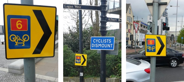
Unfortunately the ‘Cyclists dismount’ signs then appeared on the shared use railway footbridge as well – thankfully with the intervention of Sustrans (following the tweet below) they were removed.
Logic news: yesterday I could cycle this bridge; today @belfastcc *upgrades* it to an NCN route and.. pic.twitter.com/64mb0VTeLE
— NI Greenways (@nigreenways) April 29, 2014
How much work did Belfast City Council put into considering users’ needs and journey modelling? Did anyone consider that a high percentage of users’ journeys might be towards Titanic Quarter, whether tourists, day-trippers or workers? From the south, the diversion sends bewildered users across the River Lagan fully 3 times to reach this area!
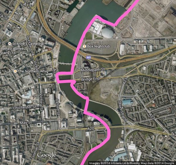
Looking at the map above, you might wonder why you need to cross two parallel bridges at all. The problem is the lack of a viable crossing – safe enough to allow pedestrians and cyclists of all abilities, people pushing prams, getting families (whether cycling or walking), those with limited mobility to safely cross four and a half lanes of fast, continuous traffic at Bridge End – as this video shows.
[youtube http://www.youtube.com/watch?v=QK56pVvzzoQ?rel=0]
This disconnect requires urgent action. One of the poorest aspects of this whole scheme is the failure to adequately cater for disrupted journeys by actually spending money on solutions. Other European cities with a keen interest in protecting and encouraging active travel make big gestures to accomodate cycling and walking through construction projects. The boardwalk idea may have its health and safety drawbacks, but has cost been a factor? Surely not within a £29.5 million project?
Similarly, Belfast City Council should be able to find roughly £60,000 to work with DRD to add a toucan crossing at Queen’s Bridge (as recommended by Sustrans). This would improve accessibility for the duration of the project, and leave a lasting legacy to the east bank of the Lagan. This is the most pressing and necessary option which Belfast City Council must pursue to salvage some pride from this sorry episode.
In the same week (trebles all round at the Press Office!) Belfast City Council have announced the contractor to deliver the Belfast Bike Hire scheme, which should now be operational by next spring. That’s right – the closure of Belfast’s premier traffic-free path, and the associated mess, will still be happening at least a year into the operation of Bike Hire.
There’s a disappointing sense that the needs of people who use this route everyday, and the all-important visitors to our city, were an afterthought in Belfast City Council’s Waterfront extension project. They’ve misjudged the importance of the path. It’s a route for tourists, for leisure use, for commuters, for shoppers and much more. Belfast City Council should be encouraged for it’s investments, both in the Conference Centre and in active travel projects like Bike Hire. But they cannot afford further failure on the day-to-day basics of encouraging car-free travel.
* * * * * * * * *
Related tweets
https://twitter.com/GregorClaus/status/461942212021215233
https://twitter.com/GregorClaus/status/461928466221633536
Sustrans Director interviewed on #NCN9 riverside route diversion at Waterfront hall on @BBCgmu – Starts at 2:13:33 http://t.co/KtHiu5fFl2
— Sustrans in Northern Ireland (@SustransNI) April 30, 2014
https://twitter.com/ellenfromnowon/status/461421963899326464
.@StripyMoggie the official hashtag is #Shamblefront which I believe is trending in my front room, nowhere else
— NI Greenways (@nigreenways) April 29, 2014
https://twitter.com/ellenfromnowon/status/461176643118460929
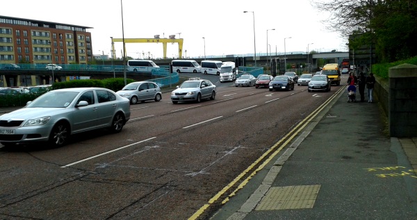
@newbelfast @bbcnewsline @nigreenways Crazy, closing public space & one of the busiest ped spaces for 2yrs! #nosigns pic.twitter.com/8QQawV4bTl
— SummitMTB_Ireland (@Summit_MTB) April 29, 2014
Safety fears as Belfast closes off-highway #cycling commuter route for two yearshttp://t.co/PcPdW20wi8 pic.twitter.com/nxgMN8PAPL
— road.cc (@roadcc) April 28, 2014
@ellenfromnowon @nigreenways @SustransNI #NCN9 part of new route to new office, what a shame. Hope there is still a cycle path after 2 yrs
— Tom Hughes (@tom_r_h) April 28, 2014
https://twitter.com/chrismccorry/status/460468494069669890
https://twitter.com/ellenfromnowon/status/460202136178262016
@LindaFStewart Still open this morning – but bridge footpaths not v cycle friendly @LizFawcett @SustransNI @belfastcc pic.twitter.com/FkC9Jz8qIS
— Alan in Belfast (Alan Meban) (@alaninbelfast) April 26, 2014
@LindaFStewart @SustransNI @alaninbelfast @belfastcc Just read this in @BelTel Exasperating 4 cycle commuters & ill-timed with @giroditalia
— Liz Fawcett (@LizFawcett) April 26, 2014
Anger as major Belfast city centre cycle route closes till 2016 http://t.co/XvgyeX3yIY
— Belfast Telegraph (@BelTel) April 26, 2014